London Street Maps by Borough
Borough Street Map Links
Barking and Dagenham; Barnet; Bexley; Brent; Bromley; Camden; City of London; Croydon; Ealing; Enfield; Greenwich; Hackney; Hammersmith and Fulham; Haringey; Harrow; Havering; Hillingdon; Hounslow; Islington; Kensington and Chelsea; Kingston upon Thames; Lambeth; Lewisham; Merton; Newham; Redbridge; Richmond upon Thames; Southwark; Sutton; Tower Hamlets; Waltham Forest; Wandsworth; Westminster
About London Borough Street Maps
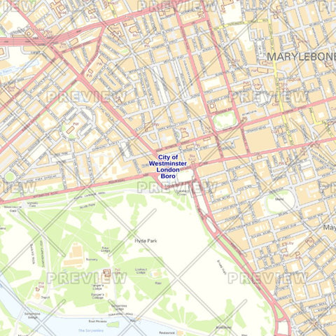
Greater London is a large geographic area covered by 33 individual London Boroughs. So, showing the entire Greater London area with every street in enough clarity to be readable is impossible on a printed wall map - therefore we have created a series of professional and customisable street maps for each London Borough.
These maps are perfect for residents, property agents, councils and local businesses needing a detailed local street map for understanding their neighbourhood or delivering products and services to the local area.
London Borough Street Map Options
When creating a street map for a London Borough, there are a number of options available to customise the map exactly to your requirement and budget described as follows:
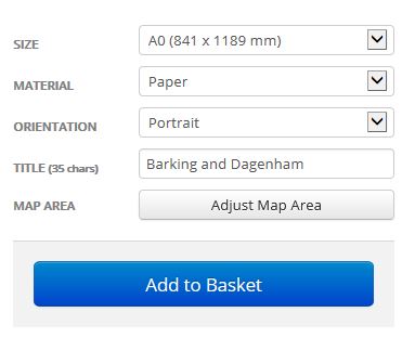
Size: Choose the paper size required from A4 to a huge 2 x A0 (1,2m x 1.7m) depending on the wall space you have available and your budget. Once you change the size of the map you can see a preview to see how your new map would look at that size.
Material: Choose just a paper map or a Plastic Coated (Encapsulated) map. Encapsulation ensures your map is protected from rips and spills so it lasts longer and allows you to draw on the map with water based marker pens.
Orientation: Change the orientation of the map between Portrait and Landscape. Note that the most appropriate paper orientation has been selected according to the shape of the London Borough so you shouldn't need to change this.
Title: Each London Postcode Borough map has been set up with the name of the London Borough as the Title. However you can change this to something else if required such as the name of your business.
Map Area: If you need to include a little more of the area around the Borough or need to focus on just a few streets you can even change the area the map covers by clicking the 'Adjust Map Area Button'
And when you are happy with the way your map looks and the price you can just hit the 'Add to Basket' button and follow the checkout instructions to place your order. Your map will be printed and delivered to you within 5 working days.
Buy a London Borough Street Map
To get started, just click on the London Borough of interest to read more about the street map for that borough:
Barking and Dagenham; Barnet; Bexley; Brent; Bromley; Camden; City of London; Croydon; Ealing; Enfield; Greenwich; Hackney; Hammersmith and Fulham; Haringey; Harrow; Havering; Hillingdon; Hounslow; Islington; Kensington and Chelsea; Kingston upon Thames; Lambeth; Lewisham; Merton; Newham; Redbridge; Richmond upon Thames; Southwark; Sutton; Tower Hamlets; Waltham Forest; Wandsworth; Westminster
You can also purchase a Greater London County Map or a Central London Street Map and also London Borough Postcode Maps!