Buy London Postcode Area Wall Maps
Greater London Postcode Area Wall Maps
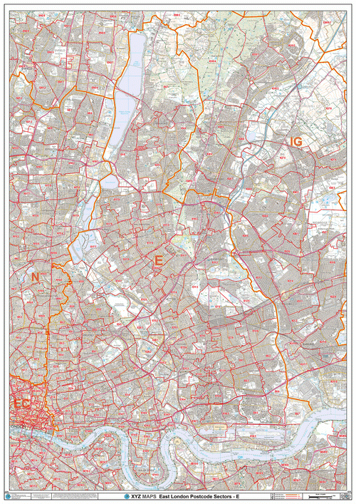
The Greater London area is covered by 20 Postal Areas including BR, CR, DA, E, EC, EN, HA, IG, KT, N, NW, RM, SE, SM, SW, TW, UB, W, WC and WD codes. It is a large area to cover and so we have two specific maps of London by Postcode Area dedicated to providing Postcode information across the capital. Click to see the Postcode District map of Greater London or the Postcode Sector map of Greater London
Central London Postcode Wall Maps With Streets
Central London is a small area covered predominantly by the EC and WC Postcode Areas. The Postcode boundaries in this part of London are very small as they cover a high density of business and residential addresses; therefore we have a specific Postcode Sector map of Central London with streets to cover just this area. This map shows the main roads and local streets with their names in addition to other points of interest such as parks, squares, museums and underground stations. Click here to see the Central London Postcode Street Map >
Postcode Maps By London Borough
The Greater London area is covered by 33 London boroughs, each with their own unique identity. In addition to the Postcode maps that cover Greater or Central London, we also offer tailor made Postcode maps for each individual London Borough allowing you to choose the size of map required, the finish and even the title you want printed on the map! Click here for more information on London Postcode maps by Borough >
Custom Made London Postcode Wall Maps
If you require a Postcode map for a specific part of London; you can use our online Maps Maker system to create a personalised London map designed to cover exactly the area you need with your own map title. Create your own London Postcode map here >