Description
Postcodes are the perfect key to unlock the locations of any residential or business address. Not only does every Postcode have a physical location, but it is used daily and is known by every resident of the UK.
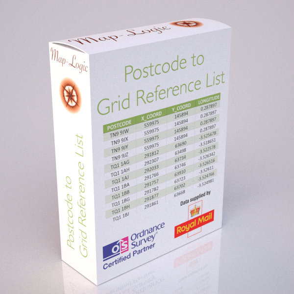
In addition to providing Postcodes with grid references for GIS and mapping applications, businesses also need to know more about their customers, staff, competitors or supply chain including which of the following geographies do they also fall into:
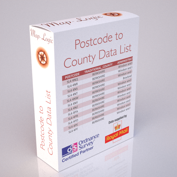
- Counties;
- Health Areas;
- London Boroughs;
- National Parks;
- Travel To Work Zones;
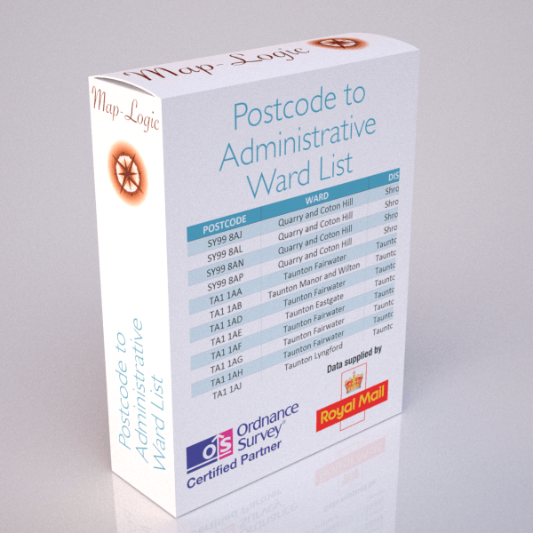
- Wards, Districts and Unitary Authorities
Therefore, we provide complete databases of over 2.5 million Postcodes related to any of the above geographies for your own internal business use. If you have questions or want to talk to someone just contact us and we'll be glad to help.
Data Supply Options
Each Postcode database is supplied in csv format as standard and split into 3 files so each can be opened in the more recent versions of Excel if required. You can simply order the database you require above and receive an immediate download link for the database of your choice..
Samples
You can download samples of each of the Postcode databases by using the links below:
- Postcode to Counties >
- Postcode to Grid Reference >
- Postcode to Health Areas >
- Postcode to London Boroughs >
- Postcode to National Parks >
- Postcode to Travel To Work Zones >
- Postcode to Wards, Districts and Unitary Authorities >
Licensing
All Postcode data products require the payment of an annual licence fee and are governed by the terms and conditions of our data licence which can be downloaded from here >. The annual licence fee includes quarterly updates at no additional cost.