City Centre Postcode Maps
Scroll down to see our range of stunning city centre Postcode wall maps for the 6 largest cities across the UK.
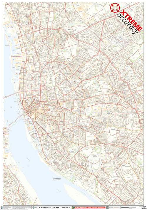
These maps shows the latest Postcode Sector boundaries over the top of accurate Ordnance Survey street mapping to provide highly detailed and accurate city centre Postcode planning maps.
Postcode Maps For Other Towns
Using the same Ordnance Survey and Postcode information we use in our published range of maps, we can create custom maps for any town in the UK!
Not only that, but you have complete control over the area the map covers, map size, finish and even what you want the title of the map to say!