Finding The Best Edinburgh (EH) Postcode Area Maps
Finding the perfect map of Edinburgh Postcodes can be difficult. Most maps are printed to cover a specific area at a scale and size which is designed to reduce the cost of printing rather than meet the needs of people who need them. And everybody needs something a little different whether that is a fast food outlet in the centre of Edinburgh needing a street map of their local area; an out of town car dealership needing a map of their area of influence; or a home services franchise needing a map of their individual franchise area covering Edinburgh and beyond.
Buy online - choose from a range of superb Edinburgh Postcode Map options guaranteed to meet your specific requirements and budget from just £34.99, delivered to you door in 5 days.
1 - Edinburgh City Centre Postcode Map
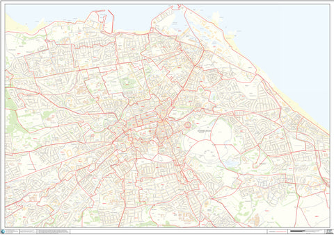
This is a popular pre-printed Postcode map of Edinburgh city centre showing Postcode Sector boundaries covering from Davidson's Mains in the West to Portobello in the East and from the coast in the North to the University in the South. The map itself is a highly detailed Ordnance Survey street map showing key points of interest and street names. Prices for this large A0 map start at £34.99. Buy Now >
2 - A Map Of The Entire Edinburgh EH Postcode Area
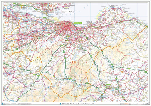
This Postcode map of the East Central Belt of Scotland covers the entire EH Postcode Area and beyond using an Ordnance Survey 1:150,000 scale colour map showing main roads, town and village names. It covers an area from Smethwick in the West to Bromford in the East and from Witton in the North to Sparkhill in the South. This map is also A0 in size and is available from just £34.99. Buy Now >
3 - Create Your Own Custom Edinburgh Postcode Map
If the three maps above don't quite meet your requirement and you want a Postcode Map to cover a specific area of Edinburgh, then you can create your own custom made map using our online Maps Maker system.
With Maps Maker, you can tailor your Edinburgh Postcode map to your exact requirement. When you are happy, just place your order and we will despatch it straight to you. Maps Maker allows you to:
- Define the exact area you want your map to cover
- Change the size of the map you want to print from A4 to a huge 2A0 size.
- Select whether you want the map printed in portrait or landscape orientation
- Select whether you want a PDF, Paper or Plastic Coated map
- Add your own title to the map such as your business name
Get started by clicking here >