0 Cart
Added to Cart
    You have items in your cart
    You have 1 item in your cart
    Total
    Check Out Continue Shopping

    Articles — postcode

    How To Match Parliamentary Constituency Information To Postcodes

    How To Match Parliamentary Constituency Information To Postcodes

    Matching Postcodes and Parliamentary Information

    The relationship between Postcodes and Constituency information is vital for many businesses in building relationships with local communities based on their organisations political footprint.

    Identifying the constituencies that employees, suppliers and customers reside in is essential for targeting localised public relations activity and communication efforts to the key geographic areas for your business..

    Linking Constituency Information To Your Own Postcode List

    It is of course possible to look up Postcodes one by one and record the constituency, MP and political party for that Postcode. However, if you have hundreds or even thousands of Postcodes, manually collecting the information is clearly not practical.

    However, if you use Microsoft Excel there is a way of doing all the work automatically at the push of a button! Watch a video overview here:

    The Excel Postcode Lookup Spread Sheet

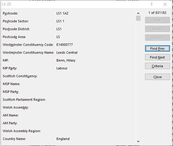
    We maintain a database of over 2.5 million Postcodes (including retired Postcodes) and the Parliamentary Constituency information related to each one.

    As Postcode and constituency data changes on a continual basis, we update all information every 3 months to ensure the spread sheet is as up to date as possible. 

    How Does It Work?

    To use this unique tool, we simply supply you with an Excel spread sheet and Access database for you to copy to a folder on your PC - no installation or technical knowledge is required (Note: you do not need to know how to use Access!).

    All you need is a current version of Microsoft Office and the ability to run macro's in Excel. It’s as simple as that!

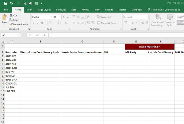
    To get started, simply open the supplied spread sheet as shown below: 

    Postcode Matching Excel Spread Sheet

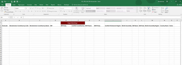
    To start matching follow these simple steps.

    1. Type or paste a list of Postcodes in column A beneath the 'Postcode' header as shown below.
      Postcode List in Excel
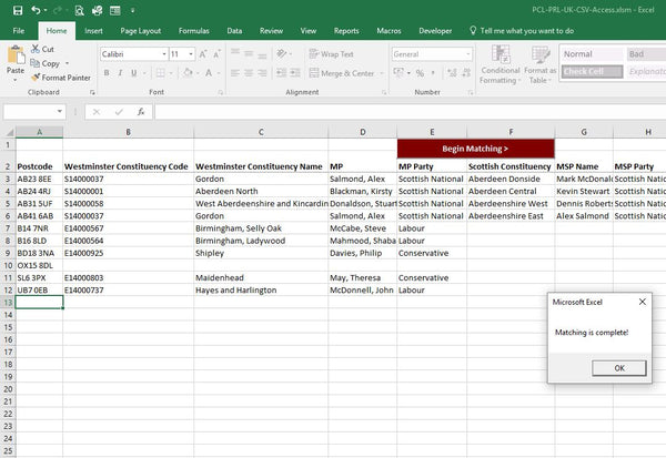
    2. Now simply click the ‘Begin Matching’ button at the top of the sheet and the columns will be populated with the relevant parliamentary constituency information automatically.
      Postcodes matched to parliamentary constituencies

    You can download the full User Guide for this Excel Spread Sheet here >

    Matching Speed

    Tests to date have shown that the spread sheet will match up to 1,000 Postcodes per minute. So for a handful of Postcodes matching is almost instant. If you need to run a large batch process then it may take a few minutes and it may be a good time to make a cup of tea!

    Postcode & Parliamentary Updates

    We update the Postcode database on a quarterly basis to take into account Postcode changes from Royal Mail and also changes to Constituency data as result of by-elections and other events.

    Licence Fees

    The spread sheet and supporting data is available for an annual licence fee of £595 plus VAT which includes all updates released during the year and unlimited support.

    The spread sheet can be ordered for immediate download directly from our Postcode to Constituency Excel Matching Spread Sheet page here >

    For more information on this Automated Excel Matching Spread Sheet, please use the contact form or call 0844 808 2495.

    Franchise Territory Mapping With Postcode Maps

    Postcodes are the most frequently used method for creating franchise territory maps across the UK. and therefore large Postcode wall maps have become an indispensable tool for visualising franchise territory coverage and planning local sales and marketing activity.

    Quality Franchise Postcode Maps

    Franchise Territory Mapping with Postcodes

    Map Logic Postcode maps are perfect franchise territory planning aids and provide the essential features required by successful franchise organisations:

    • Large A0 (119cm x 84cm) wall maps for easy viewing across the office.
    • Accurate Postcode boundaries from the latest official Royal Mail Postcode information.
    • Clear mapping from Ordnance Survey - the National Mapping Agency of Great Britain.
    • Long lasting and durable encapsulation (plastic coating) to maximise the life of your map.
    • No-quibble 14 day money back guarantee if you are not completely satisfied with your purchase.

    You can see which of our ready-made maps cover your franchise area by entering your town in the box below and clicking Go:

    Find available maps for the town of:

    Customise Your Franchise Territory Map

    Personalised Franchise Postcode Territory Maps

    Because all franchise businesses are different, we also offer a highly flexible customised map service to create the perfect map for your franchise. Used by banks, charities, automotive dealerships, gyms and even weight loss franchises, these maps offer:

    • Various sizes from A4 to 2A0 (168cm x 119cm)
    • Customisation to cover your specific geographic area and the Postcodes covered by your franchise.
    • The ability to add your franchise territory border to the map
    • Full personalisation with your franchise name as the map title!

    You can have a look at our custom map options online! Simply enter your town name in one of the search boxes below to get started:

    Create a Postcode District (e.g. OX7) map for the town of:

    Too Many Options?

    Not sure which option is right for you? Just let us know what you need and we will come back with the best options for you to consider.

    Using The Excel Data Form To View Postcode Records

    Due to recent versions of Excel allowing over 1 million records on a work sheet, we provide more Postcode data in this format than in any other including the latest release of the Postcode & Constituency lookup data. However, with around 2.5 million Postcode records spread across 3 work sheets, finding the specific Postcode you want and viewing the information associated with it may be frustrating.

    You can perform a quick search in Excel by hitting CTRL > F and entering a Postcode which will find the row you want, but then the information is displayed in columns across the page making it difficult to read.

    So this short tutorial shows how you can find a Postcode using Excel's built-in data form which also makes reading the information associated with the Postcode much easier.

    Setting Up The Built In Data Form

    Unfortunately the Data Form in Excel is usually hidden and you have to add it to your Quick Access Toolbar before you can use it. The following steps will show you how to do this but once it is done, the Data Form will be available whenever you use Excel in future.

    Click the little arrow at the top of Excel which is called Customise Quick Access Toolbar and click More Commands.

    Excel Customise Quick Access Toolbar
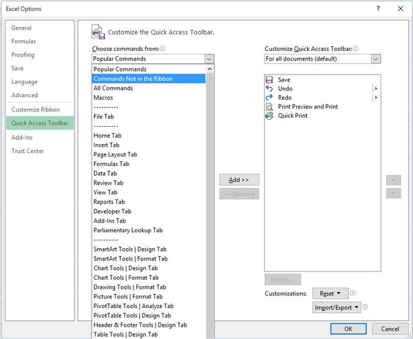
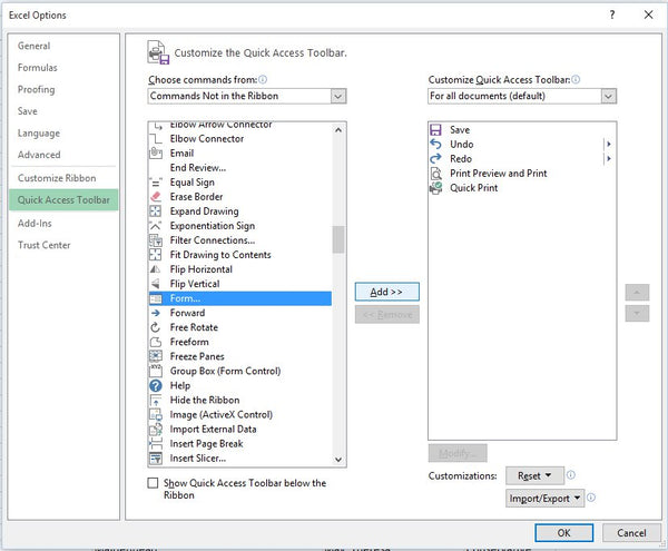
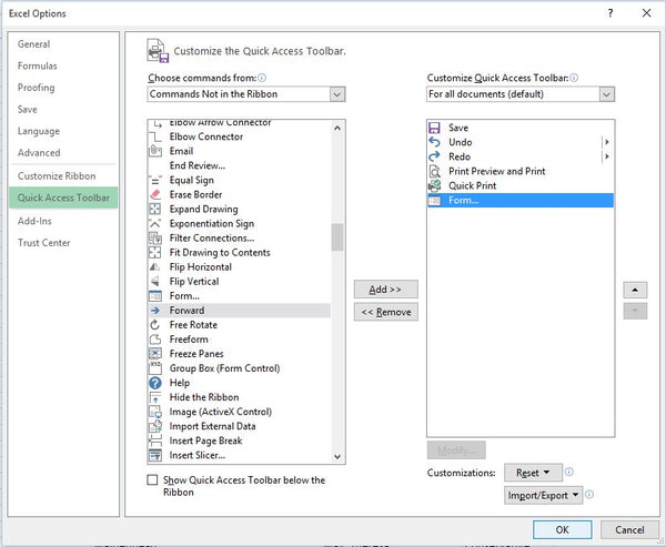
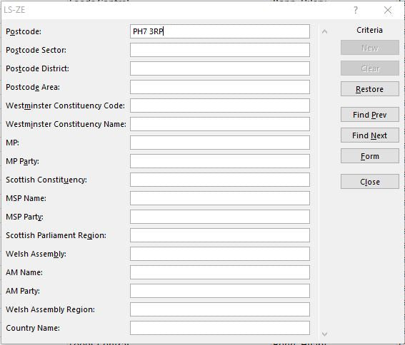
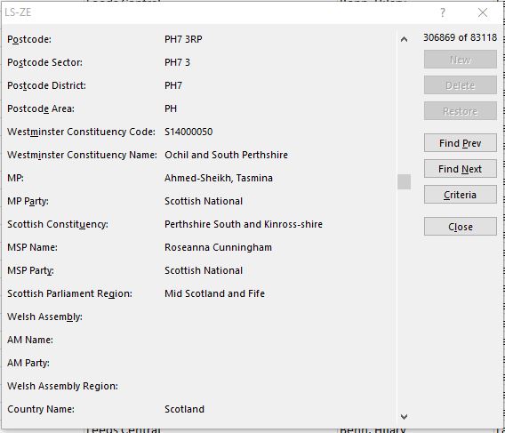
When you click More Comments, you will see the dialogue box below:

    Excel Toolbar Options

    Click the left hand drop down list under Choose commands from and select the option highlighted in the image above: Commands Not in the Ribbon. The list box will then change to that shown below.

    Adding the Form command to the ribbon

    In the list to the left, find and click on the item call Form and then click the Add button in the middle. The box on the right should then contain the Form item as shown below.

    Form button added to ribbon

    When you click OK in the bottom right of the dialogue, you will return to Excel and will see the Form button in your Quick Access Toolbar at the top as highlighted in the image below.

    Data Form Added to Quick Access Toolbar

     Your Form button is now ready to use and the next steps will show you how!

    Using The Built In Data Form

    Now you have access to the Excel Data Form, the following steps show how to use it through illustration with our Postcode & Constituency Excel spreadsheet. In this spreadsheet we have all UK Postcodes and Parliamentary information spread across 3 work sheets (because each sheet is limited to approximately 1 million rows) as follows:

    1. AB-LN for all current Postcodes in the respective Postcode Areas.
    2. LS-ZE for all current Postcodes in the respective Postcode Areas.
    3. Retired for all Postcodes which are no longer in use by Royal Mail.

    For our example, we want to find the Parliamentary information for Postcode PH7 3RP and as the form only works on a sheet (rather than the entire workbook) we need to click on the LS-ZE tab which contains all the Postcodes for the PH Postcode Area.

    Once there, select any cell and then click your Form button in the Quick Access Toolbar to show the dialogue below.

    Excel Form Dialogue

    Note that all the data elements are greyed out. This is because the spread sheet is protected by default to avoid accidental deletion or over-writing of the information it contains.

    Click on the Criteria button to the right and you will see the dialogue below. Note that the data fields are now white allowing you to type into them. In the field for Postcode type PH7 3RP and hit Enter on your keyboard.

    Finding a Postcode using the Excel Form

    You will now see the form below displaying all the Parliamentary Constituency information associated with PH7 3RP in a nice and easy to read format.

    Parliamentary information for Postcode PH7 3RP

     We hope this quick introduction to the Excel Built-in Data Form proves to be useful but if you have any questions or suggestions we would love to hear from you.

    Finding The Best Edinburgh (EH) Postcode Area Maps

    Finding the perfect map of Edinburgh Postcodes can be difficult. Most maps are printed to cover a specific area at a scale and size which is designed to reduce the cost of printing rather than meet the needs of people who need them. And everybody needs something a little different whether that is a fast food outlet in the centre of Edinburgh needing a street map of their local area; an out of town car dealership needing a map of their area of influence; or a home services franchise needing a map of their individual franchise area covering Edinburgh and beyond.

    Buy online - choose from a range of superb Edinburgh Postcode Map options guaranteed to meet your specific requirements and budget from just £34.99, delivered to you door in 5 days.

    1 - Edinburgh City Centre Postcode Map

    Edinburgh City Centre Postcode Map

    This is a popular pre-printed Postcode map of Edinburgh city centre showing Postcode Sector boundaries covering from Davidson's Mains in the West to Portobello in the East and from the coast in the North to the University in the South. The map itself is a highly detailed Ordnance Survey street map showing key points of interest and street names. Prices for this large A0 map start at £34.99. Buy Now >

    2 - A Map Of The Entire Edinburgh EH Postcode Area

    EH Postcode Map

    This Postcode map of the East Central Belt of Scotland covers the entire EH Postcode Area and beyond using an Ordnance Survey 1:150,000 scale colour map showing main roads, town and village names. It covers an area from Smethwick in the West to Bromford in the East and from Witton in the North to Sparkhill in the South. This map is also A0 in size and is available from just £34.99. Buy Now >

    3 - Create Your Own Custom Edinburgh Postcode Map

    If the three maps above don't quite meet your requirement and you want a Postcode Map to cover a specific area of Edinburgh, then you can create your own custom made map using our online Maps Maker system.

    Custom Edinburgh Postcode Map

    With Maps Maker, you can tailor your Edinburgh Postcode map to your exact requirement. When you are happy, just place your order and we will despatch it straight to you. Maps Maker allows you to:

    • Define the exact area you want your map to cover
    • Change the size of the map you want to print from A4 to a huge 2A0 size.
    • Select whether you want the map printed in portrait or landscape orientation
    • Select whether you want a PDF, Paper or Plastic Coated map
    • Add your own title to the map such as your business name

    Get started by clicking here >


    Postcode & Address Updates In Numbers - February 2015

    As housing and business premises are built, demolished or renovated across the UK, Postcode geography and national address databases have to adapt to reflect these constant changes. Keeping this information up to date is an essential task that Royal Mail undertake on a continual basis and we use this information to ensure all of our products are regularly maintained.

    Read more