0 Cart
Added to Cart
    You have items in your cart
    You have 1 item in your cart
    Total
    Check Out Continue Shopping

    Articles

    Why Postcodes Change

    Why Postcodes Change

    The Postcode system is dynamic - it changes frequently with around 1.25 million address changes in an average year. There are times when Royal Mail are forced to make changes to the Postcode system in order to maintain postal delivery efficiency.

    For example, new housing developments or business parks in already densely populated areas can leave no free postcodes for Royal Mail to allocate. this can lead to the recoding of a wider area to create additional codes to allocate.

     Update Frequency

    Royal Mail are continually updating the national address database but they release Postcode update summaries every 6 months which provide broad details concerning which areas have been affected. See below for the latest Postcode release information.

    Map-Logic provide updates to all associated databases and tables every 3 months to help ensure your data content is as accurate and up-to-date as possible.

    Latest Postcode Changes

    The documents linked to below detail the latest Postcode changes and address statistics for reference.

    Business & Vacant Organisations

    This table shows the number of businesses and vacant organisations on the Royal Mail address database, the Postcode Address File (PAF®). The table compares the latest month's figures with those from the previous month, identifying the percentage variation between the months. > Download

    PAF® Delivery Point Changes

    This document shows the number of delivery point additions, deletions and changes and the reasons for the change.
    > Download

    New Sectors & Localities

    This table shows the sectors and localities applied to the Postcode Address File (PAF®) system this month.
    > Download

    Overall PAF Statistics and Changes

    This table shows the total numbers of, and number of changes to, Postcodes, localities, Post Towns, delivery points and other PAF elements. > Download

    What Does Map Scale Mean?

    Map Scale

    Map scale can be a tricky thing - it restricts the options for the amount of information you can have on a map and it can also be a little tricky to explain why! We get a lot of requests for maps that just won't work - including requests for single wall maps of the UK at street level - read on to find out how and why.

    Introduction to Map Scales

    Modern map scales are usually represented as a ratio and the most common map scales displayed in this way are:

     1:10,000 (large scale)

    1:50,000

    1:100,000

    1:250,000

    1:800,000

    1:1,000,000 (small scale)

    But what do these actually mean?

    Very simply, and taking 1:50,000 as an example, 1 cm measured on the map will equal 50,000 cm in the real world. So if we measured the distance between two points on a 1:50,000 scale map as 40 cm then the actual distance in the real world would be 2,000,000 cm or 12.427 miles.

    By comparison, on a 1:800,000 scale map, 40 cm would be the equivalent of 198.839 miles.

    Example Map Scales

    1:800,000

    1:800,000

     
    1:150,000

    1:150,000

     
    1:15,000

    1:15,000

    Summary

    For the above reason, it become clearer why our local Postcode Sector maps are at a scale of 1:150,000 scale but the national map is at 1:800,000 scale - the national map covers a much larger area than the Postcode Sector maps and therefore we have to squeeze more miles into each centimetre on the map.

    Street Level UK Map

    So what about that street level map covering the UK? What is the problem?

    First we have to consider the amount of detail you need to be able to display streets, with their names, on a wall map. To do this properly on any piece of paper without making the streets blur together or making the street names illegible means that you can only squeeze about 1/10th of a mile into each cm on the map. Try and squeeze more in and the street detail is lost.

    So, working from here, if you were to have a UK map at street level when you can only squeeze 1/10th of a mile into each cm then the wall map you would need would need to be approximately 60 metres high and 36 metres wide. You'd need a pretty big wall to mount the map on!

    Map Options

    If you really do need street level detail for your business (or leisure activities) then consider the following options:

    1. Do you really need all the UK covered or is it just certain target areas such as major cities? Whilst this would require multiple maps it is technically possible and may prove to be economically viable.

    2. Can you make do with a national map and PC based street maps for reference? For example, a national wall map for reference purposes but then one of the ever-improving PC map systems such as Multimap, Google Maps or Google Earth which you can use off line.

    3. Does your requirement justify investment of more specialist mapping software? These systems can cost from a few hundred pounds to many thousands and selecting the right one for you can be tricky but they are highly customisable and can be extremely powerful.

    Whatever your requirement, if you are stuck or need advice then just let us know - we'll be glad to offer our assistance.

    Mapping Software

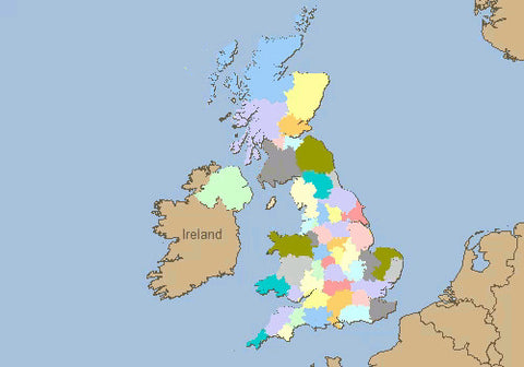
    Mapping Software & GIS

    Mapping software has been around for a many years but the internet has really brought computerised maps into daily use over the past 20 years.

    The problem with 'mapping software' is that the price you pay generally depends upon two key factors:

    1. The software itself and what it is capable of; and

    2. The data used in the maps. The amount of data you need and the more detailed and more up to date it is - the more expensive it is. (However Ordnance Survey have recently released a lot of their data for free which has chnaged this for the better)

    To make life simple, this article categorises mapping software into 3 broad 'camps' which are described below along with an overview of which solutions are best for various requirements. If you are not sure which solution is best for you and you want some free advice then just use the brief us form to let us know what you want to do and we will offer you impartial advice on the best solution.

    Free Maps

    Google Earth & Google Maps
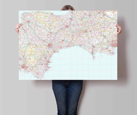
Free computer maps are generally limited to internet-based solutions and, in the UK, the main providers of free mapping sites are Google, Microsoft Live Maps and Multimap.

    In addition to these, you can download Google Earth for free and play for hours exploring the world.

     All of these systems provide a detailed level of information (streets) for the UK and allow simple navigation tools to find a location of interest. Most also allow you to measure distances, add points of interest or calculate routes between locations.

    Applications

    These systems are ideal for visualising simple data geographically as general reference tools or for planning routes.

    Desktop Business Mapping

    MapPointFor many businesses, maps play an important strategic and operational role and the free map systems described above don't offer the right information or provide enough functionality to do what they need. For example many businesses rely on maps to:

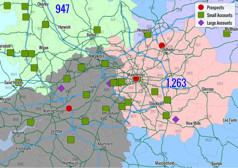
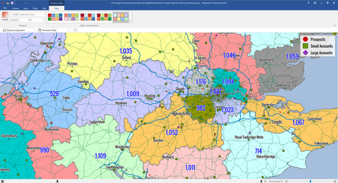
    1. Target mailing campaigns to consumer demographics,

    2. Create, optimise and manage sales territories

    3. Create and communicate franchise areas

    3. Analyse customer concentrations across a region and so on.

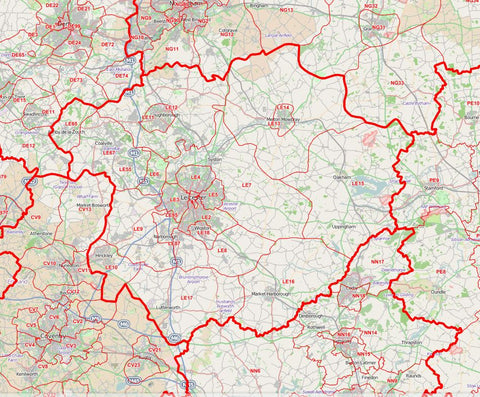
    These types of applications require additional data (such demographic information or postcode data) and additional functionality in the software.

    At the moment there is really only one choice in this area of entry-level business mapping software at a reasonable price which is Microsoft MapPoint. Previous versions have had mixed reviews but, for a mapping system costing less than £400 it is a good option and hopefully the new version has ironed out any previous problems.

    Applications

    These systems are ideal for undertaking common business analysis and planning functions such as creating sales territories, mapping your own customer or sales data, mapping population demographics and so on.

    Geographic Information Systems

    ArcView GISAt the top of the mapping software in terms of power and sophistication range are the Geographic Information Systems. Before the internet and the likes of Google and Microsoft got involved - these were the only providers of PC based mapping software.

    These systems are essentially completely customisable. You can choose the features you want and the data you need to be included in your system but, as a result, they are not cheap. A basic system from a supplier such as Pitney Bowes MapInfo or ESRI is likely to cost you in the region of £5,000+ and the chances are there will be annual renewal fees for the software and data as well. And this is just to use the system on one PC!

    But what these systems don't do isn't worth knowing about. Optimisation techniques, 3D visualisation, cartographic manipulation and so on - these systems are not for the faint-hearted and generally require training and support services to help you get the most our of your investment.

    Applications

    Such systems are used in areas where they really do provide indispensible work and highly profitable returns. Examples are store location optimisation for large retailers; environmental risk assessment for insurance, sales territory management for FMCG companies. Where deployed correctly, these systems are certainly worth their weight in gold...

    Address Cleaning

    The Postal Address Database PAF

    The Postcode Address File from Royal Mail is the essential database of UK addresses.

    PAF® can provide significant costs savings to any business by reducing the amount of time taken to capture customer addresses either over the phone or via your website. Additional benefits of streamlined address entry are increased customer satisfaction and reduced web purchase abandonments.

    As the only complete source of UK addresses and Postcodes, PAF® also ensures you get the address right first time – essential for correct mail delivery and protecting your business’ professional image to aid customer retention. Correcting address spelling mistakes and formatting errors can also be very time consuming and costly if attempted after the event.

    PAF® also helps you sort your mail with a full list of correct Postcodes, helping to reduce your postage costs with various Royal Mail services such as Mailsort®, Presstream® and Cleanmail®. Postage costs can further be reduced by improving or removing poor quality addresses by comparison to the national address database.

    Whatever the nature of your business, whether you despatch products to your customers or communicate with them via direct mail, you need PAF® to do it efficiently and professionally.

    The latest update of PAF incorporates over 50,000 changes to delivery points (addresses) and over 3,000 Postcode changes including nearly 2,000 new Postcodes and over 1,000 Large user Postcodes deleted. As Large user Postcodes are predominantly used by businesses receiving high volumes of mail we wonder whether the reduction of large user Postcodes is a sign of the struggling economy?

    For more information on PAF please visit our Postcode Address File product page.

    Why Postcodes Are Great For Business

    Postcode Wall Map

    For a system which was designed purely to simplify the delivery of mail to any property in the UK, the postcode has become an essential tool in the operations of almost every business in the UK. This article looks at some of the more common and powerful applications of the Postcode in businesses of all sizes.

    Postcode Overview

    There are approximately 1.7 million Postcodes covering the United Kingdom - a mix of large user Postcodes for businesses who receive large quantities of mail, non-residential Postcodes for small businesses and residential Postcodes which are shared, on average, by around 15 residential properties - usually a street.

    Postcode Districts

    One important feature of the Postcode system for businesses is that it is hierarchical - Postcodes are geographically grouped into Postcode Sectors (e.g. all Postcodes beginning with UB7 0 are grouped together) which in turn are grouped into Postcode Districts and these are grouped into the 124 Postcode Areas (e.g. UB). This makes it a perfect framework for covering the UK from a national level to a local street level.

    To find out more about the Postcode read the related articles on the History of the Postcode and the Postcode Structure.

    Locating Customers

    One of the simplest uses of the Postcode is to find out where a business or residential customer is! Punch a Postcode into Google maps and you will see - reasonably accurately - where your customer is. In general the Postcode will take you to the correct street and from there you should be able to find the house number.

    This ability to locate customers, prospects or suppliers has been extended using software systems that can then take a number of locations and plan the most efficient (quickest and most cost-effective) route to create a sales persons call plan or a logistics delivery route.

    Customer Locations

    Locating addresses in this way is also used to allocate customers and prospects to field sales teams where sales territories and areas are defined by Postcode (see below). For example, if you receive an enquiry from a customer whose location is in LS26 3PX then you can easily allocate that prospect to your sales person who is responsible for the LS26 Postcode District.

    This is one of the most common applications for Postcode wall maps and AlignMix Territory Mapping Software.

    Sales Territories

    The most common way of defining field sales areas is also through the use of the Postcode system.

    Postcode Sector or District maps are generally the most popular maps for this purpose as they offer a a contiguous and complete coverage of the United Kingdom and can be allocated to named sales people based on the persons home location.

    Postcode based sales territories

    But using the Postcode can also make it easier to ensure that your sales people have the same workload or sales opportunities.

    Using your customers Postcodes, you can run some analysis to determine the number of customers in each Postcode District and then allocate Districts to your sales people, adding up the customers as you go, until your sales people have an equal number of customers to visit.

    This approach can help reduce one of the biggest causes of conflict in a field sales force - who has the most sales (and therefore commission) potential.

    Franchise Areas

    Franchise businesses have boomed over the past 30 years allowing people to have the opportunity of being their own boss with the security of the backing of a large successful business. Most franchises plan their network using the Postcode to ensure that franchisees do not encroach on other franchise areas.

    National franchise areas

    In many cases, a Postcode District based franchise map (which illustrates for each franchisee the area they are allowed to trade in and market to) is provided as an appendix to the franchise contract.

    Franchises can benefit from wall maps of their franchise areas to clearly visualise franchise territories and also from software to help analyse, plan and create the optimum franchise structure.

    Further Information

    Most businesses rely on Postcode information in some way, so if you have a need to analyse, map or plan using Postcodes then just give us a call or send us a message and we'll be glad to help.