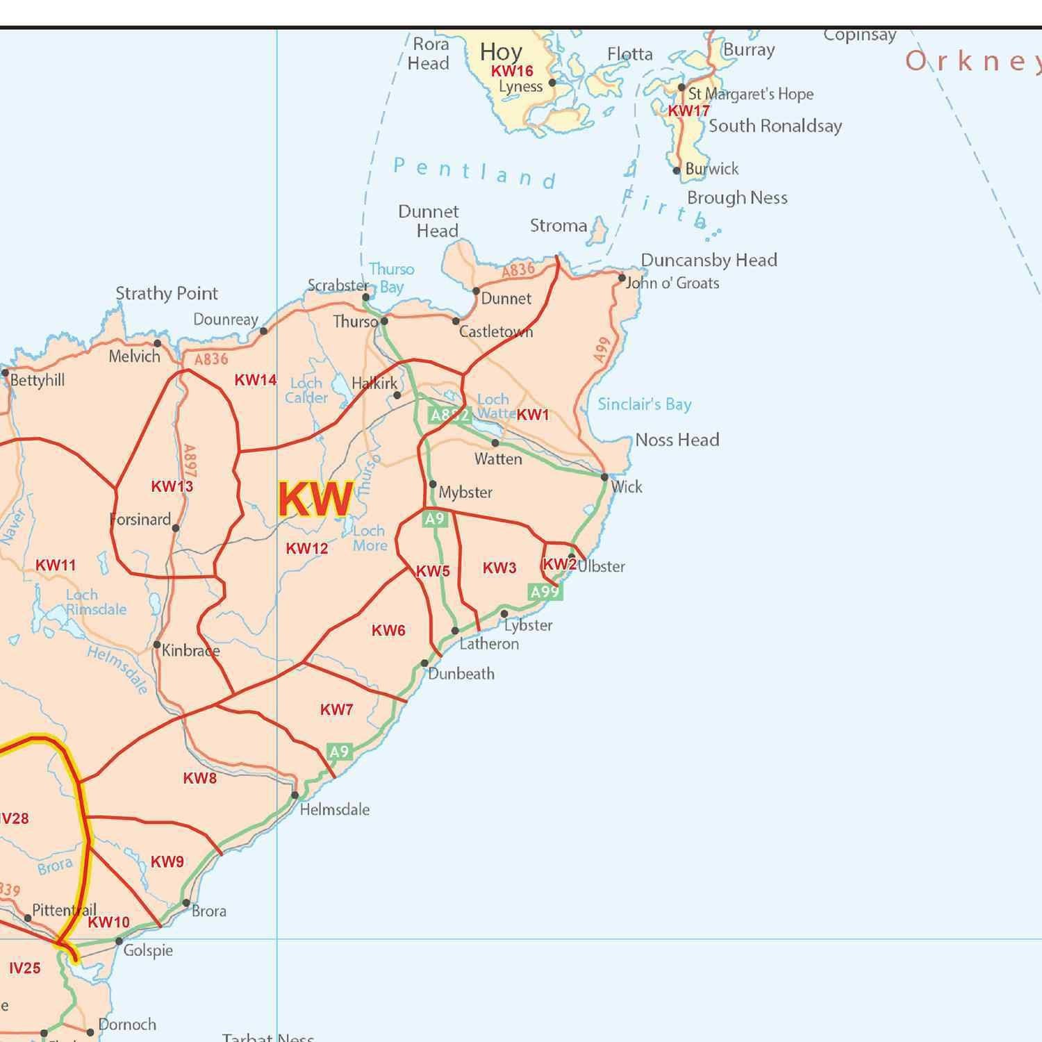
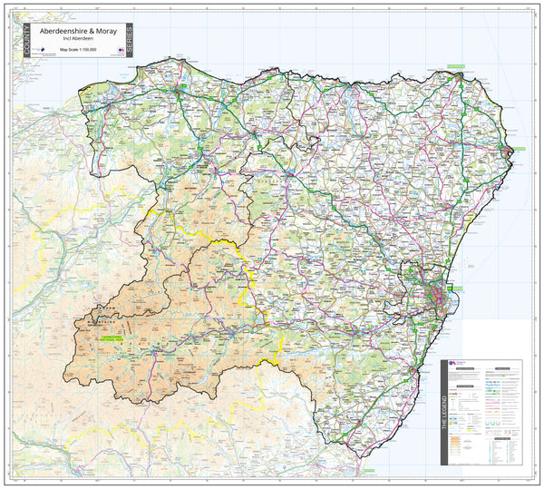
Aberdeen Postcode Map (AB)
Aberdeenshire Moray, Angus and Forfar County Map (2021)
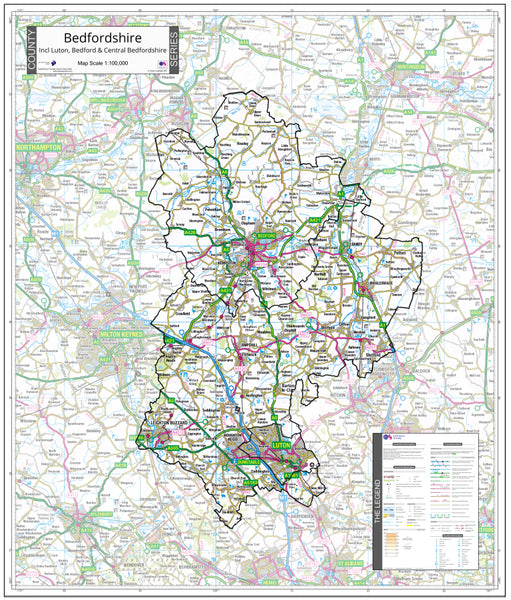
Bedfordshire County Map (2021)
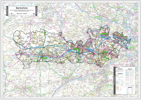
Berkshire County Map (2021)
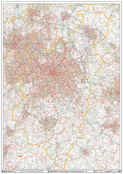
Birmingham Postcode Map (B)
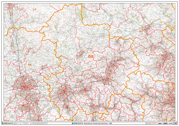
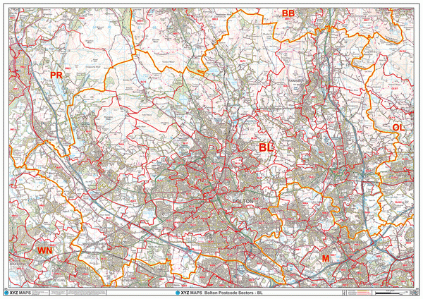
Blackburn Postcode Map (BB)
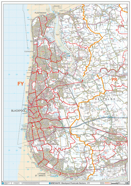
Blackpool Postcode Map (FY)
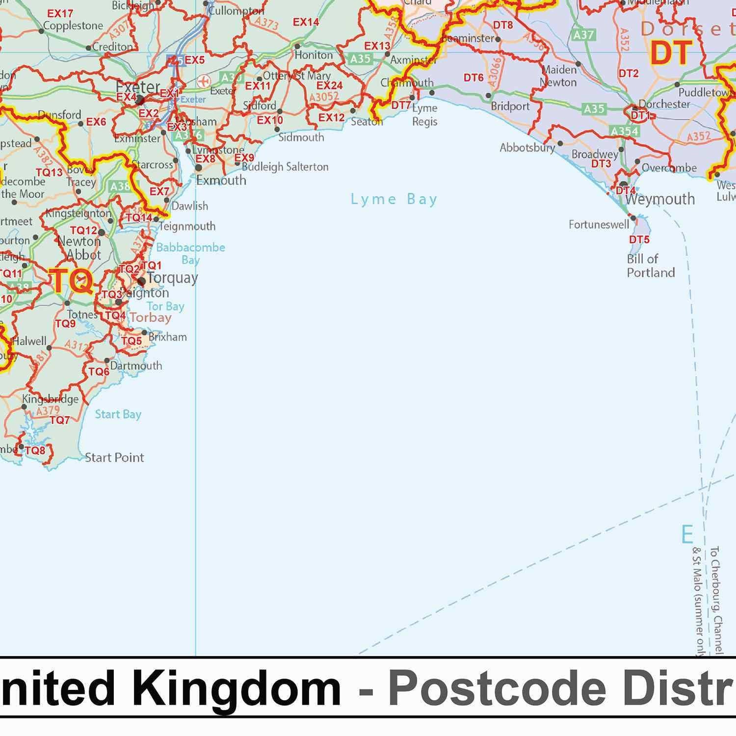
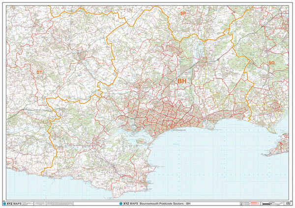
Bournemouth Postcode Map (BH)
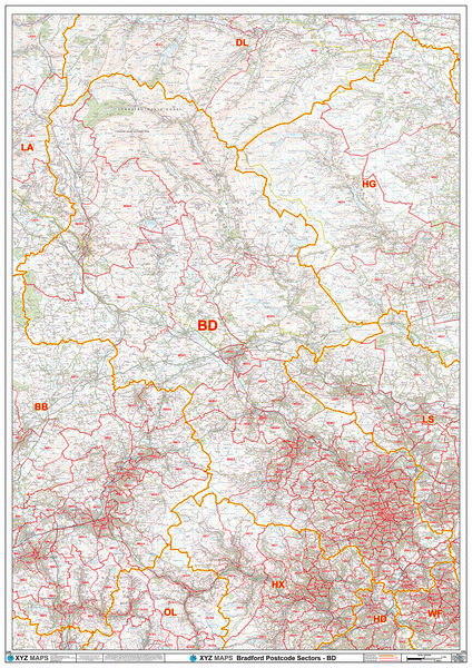
Bradford Postcode Map (BD)
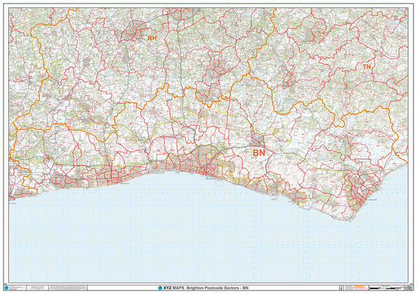
Brighton Postcode Map (BN)
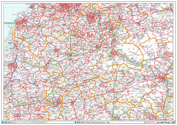
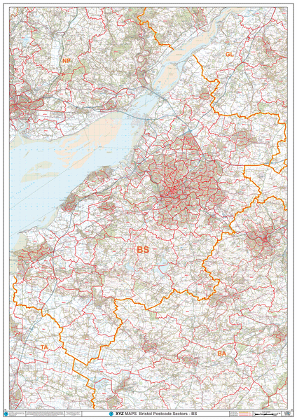
Bristol Postcode Map (BS)
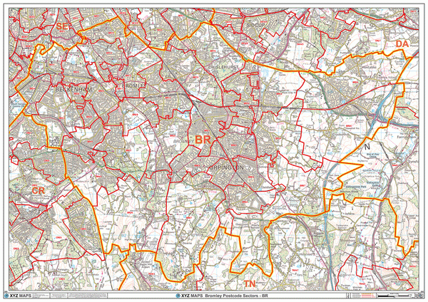
Bromley Postcode Map (BR)
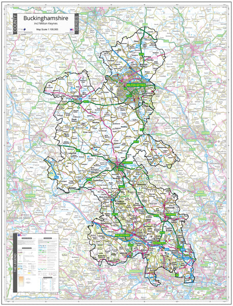
Buckinghamshire County Map (2021)
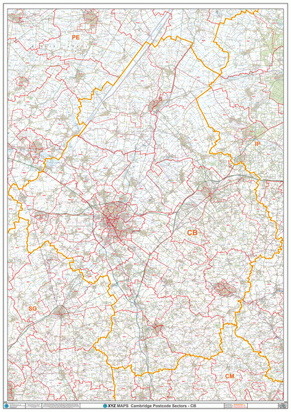
Cambridge Postcode Map (CB)
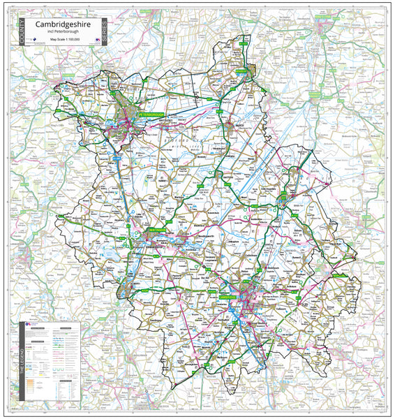
Cambridgeshire County Map (2021)
Canterbury Postcode Map (CT)
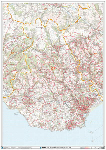
Cardiff Postcode Map (CF)
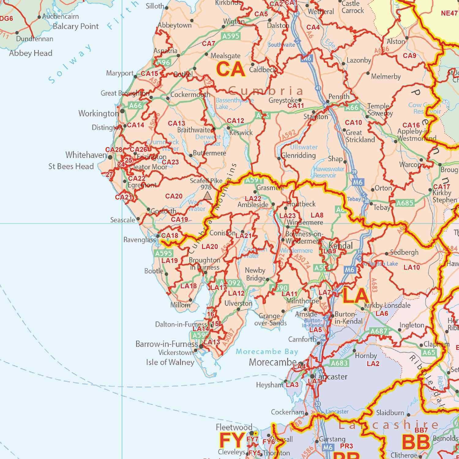
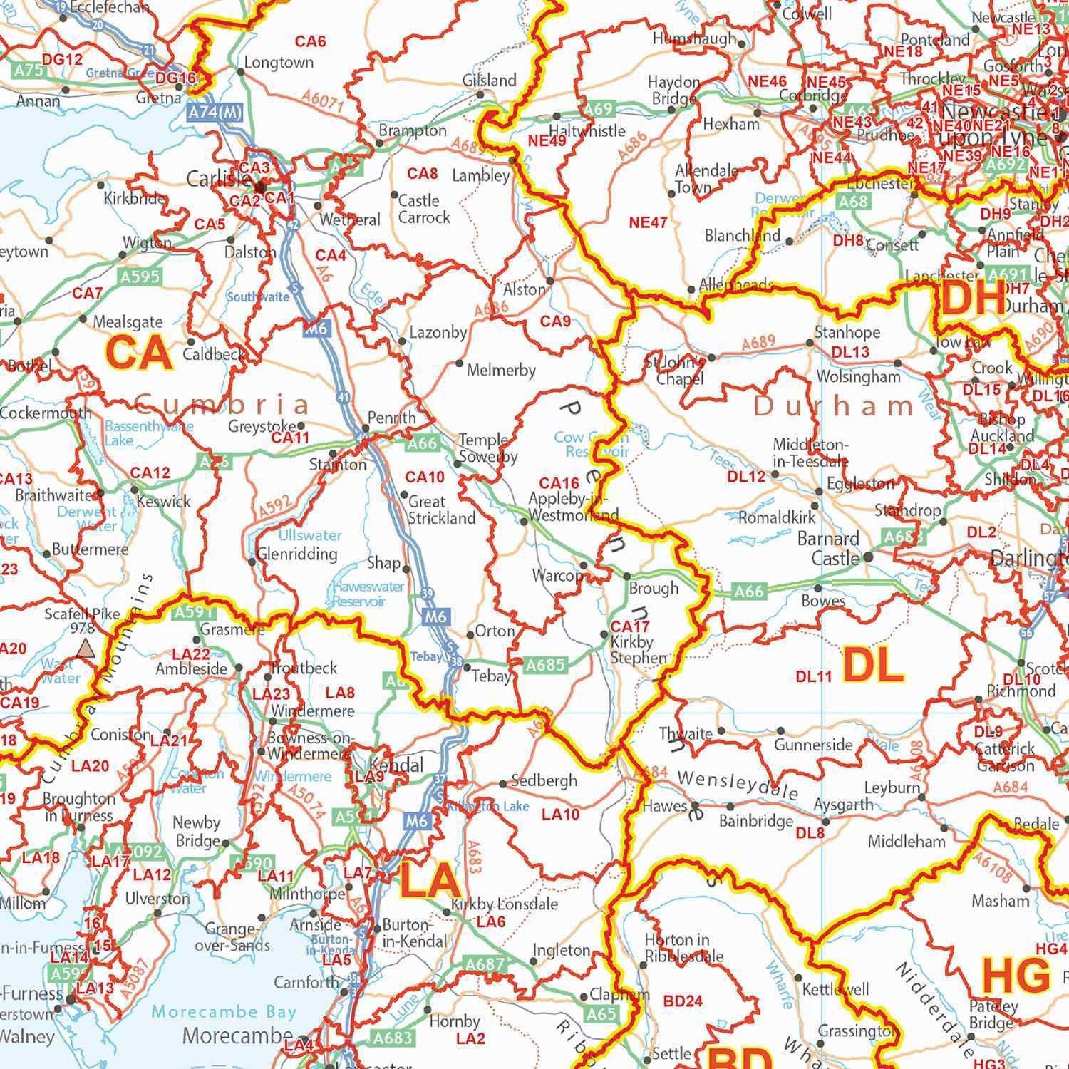
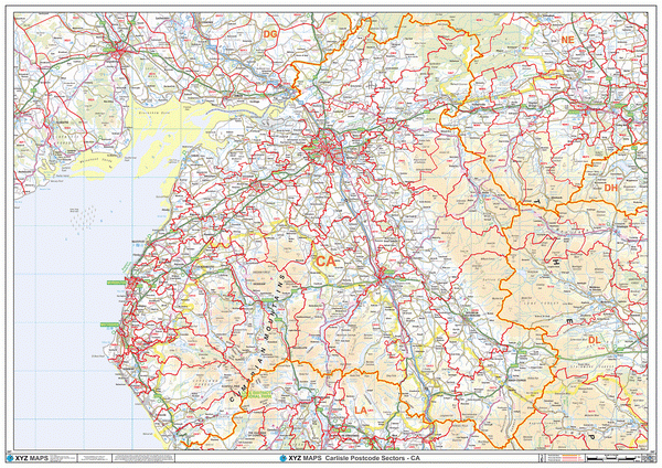
Carlisle Postcode Map (CA)
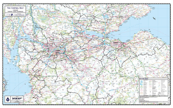
Central Belt of Scotland County Map (2021)
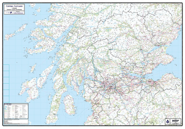
Central Scotland County Map (2021)
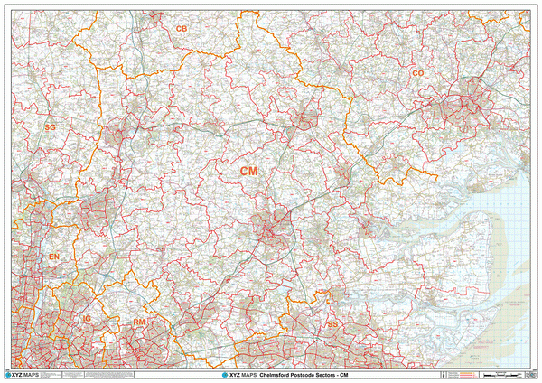
Chelmsford Postcode Map (CM)
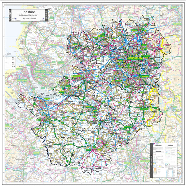
Cheshire County Map (2021)
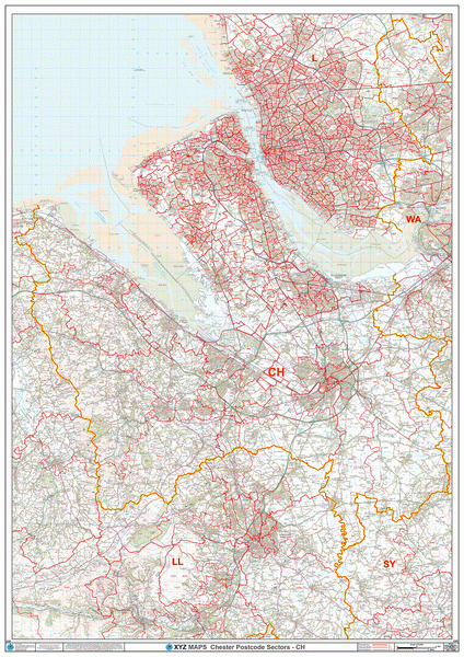
Chester Postcode Map (CH)
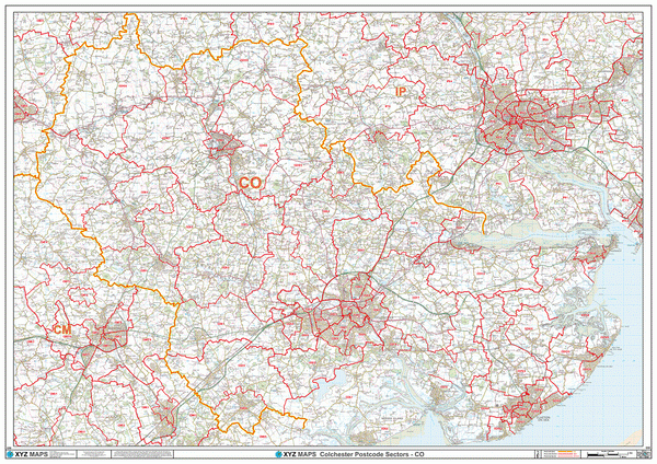
Colchester Postcode Map (CO)
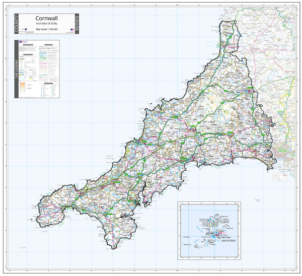
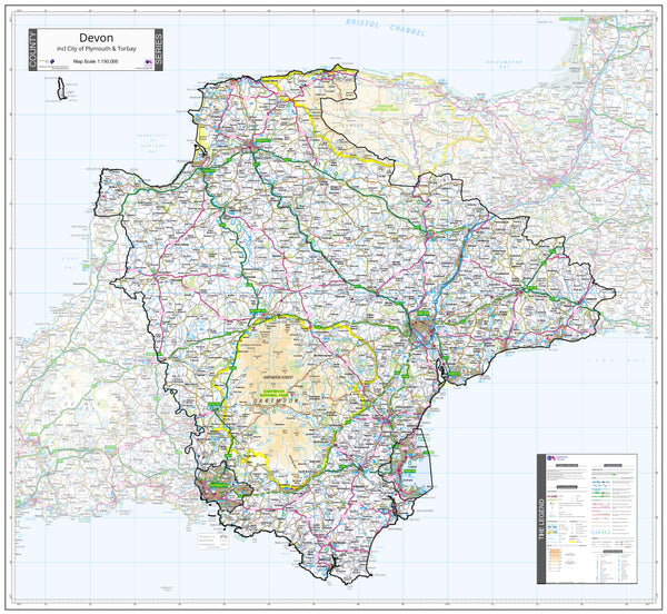
Cornwall County Map (2021)
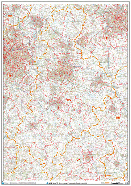
Coventry Postcode Map (CV)
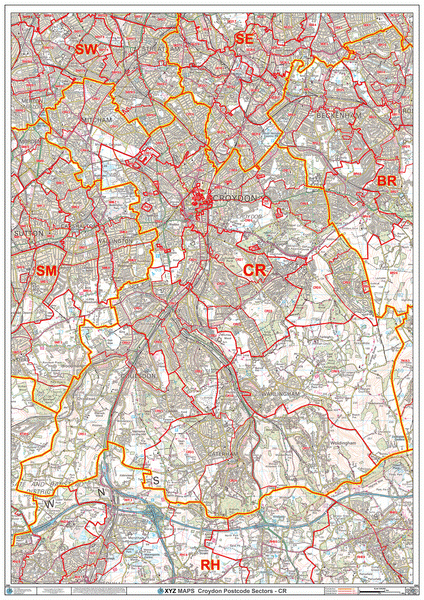
Croydon Postcode Map (CR)
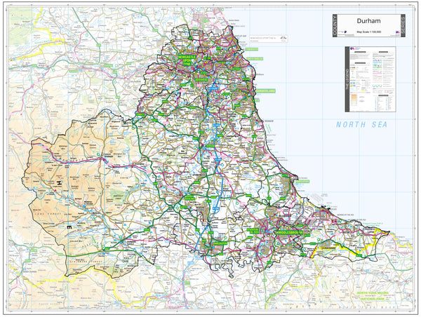
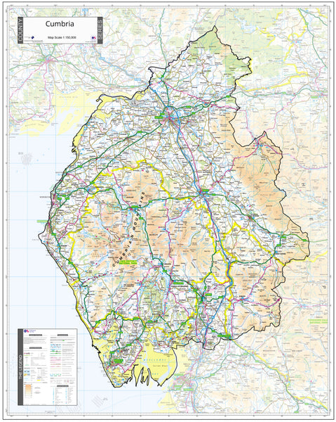
Cumbria County Map (2021)
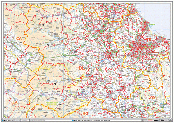
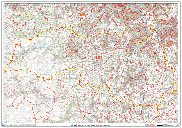
Darlington Postcode Map (DL)
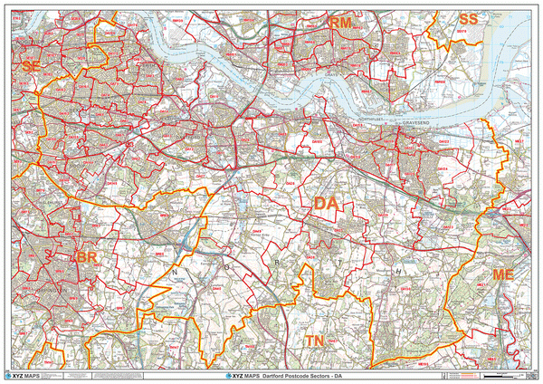
Dartford Postcode Map (DA)
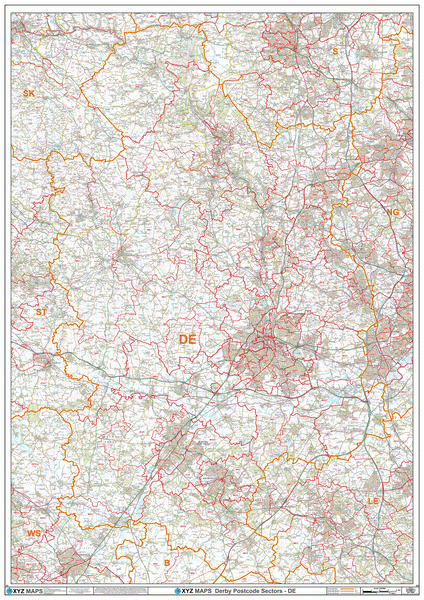
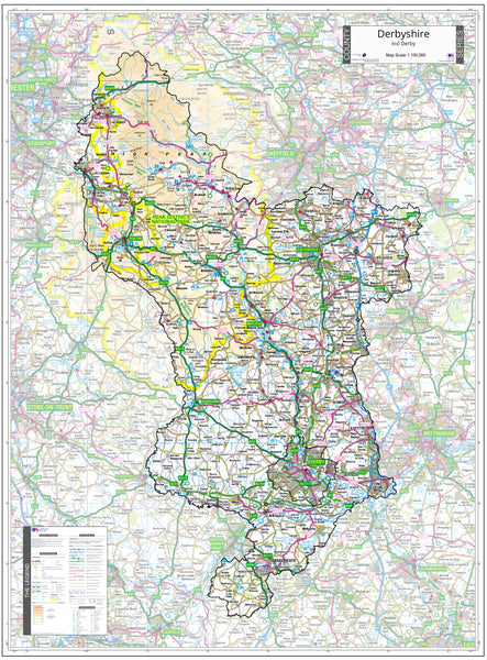
Derbyshire County Map (2021)
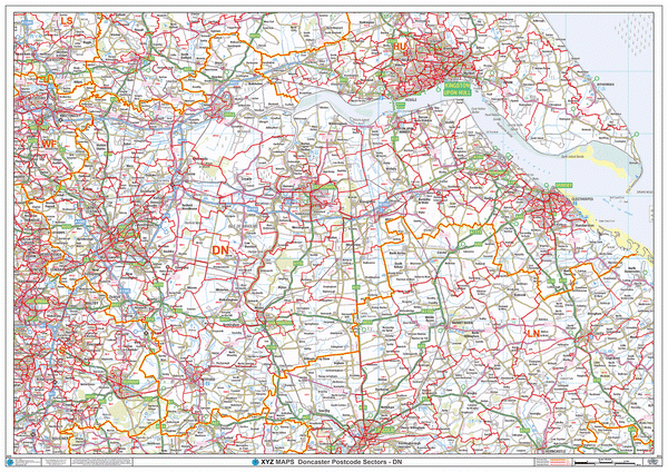
Doncaster Postcode Map (DN)
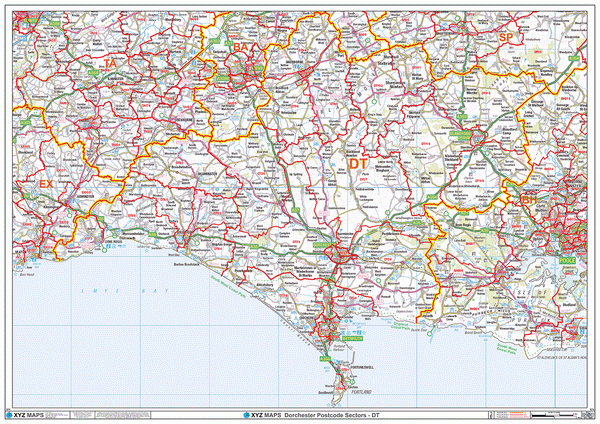
Dorchester Postcode Map (DT)
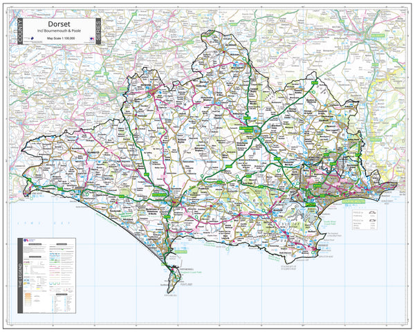
Dorset County Wall Map - Latest Ordnance Survey Boundaries (2021)
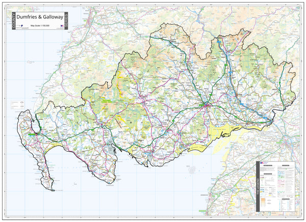
Dumfries and Galloway County Map (2021)
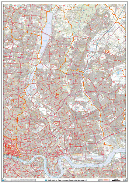
East London Postcode Map (E)
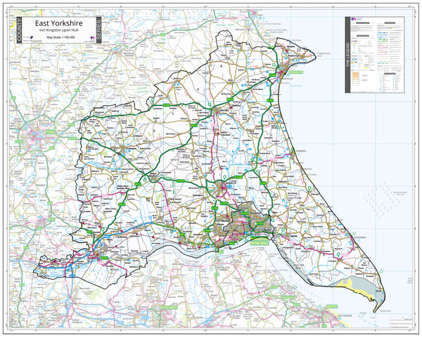
East Yorkshire County Map (2021)
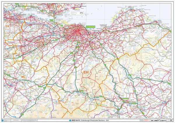
Edinburgh Postcode Map (EH)
Enfield Postcode Map (EN)
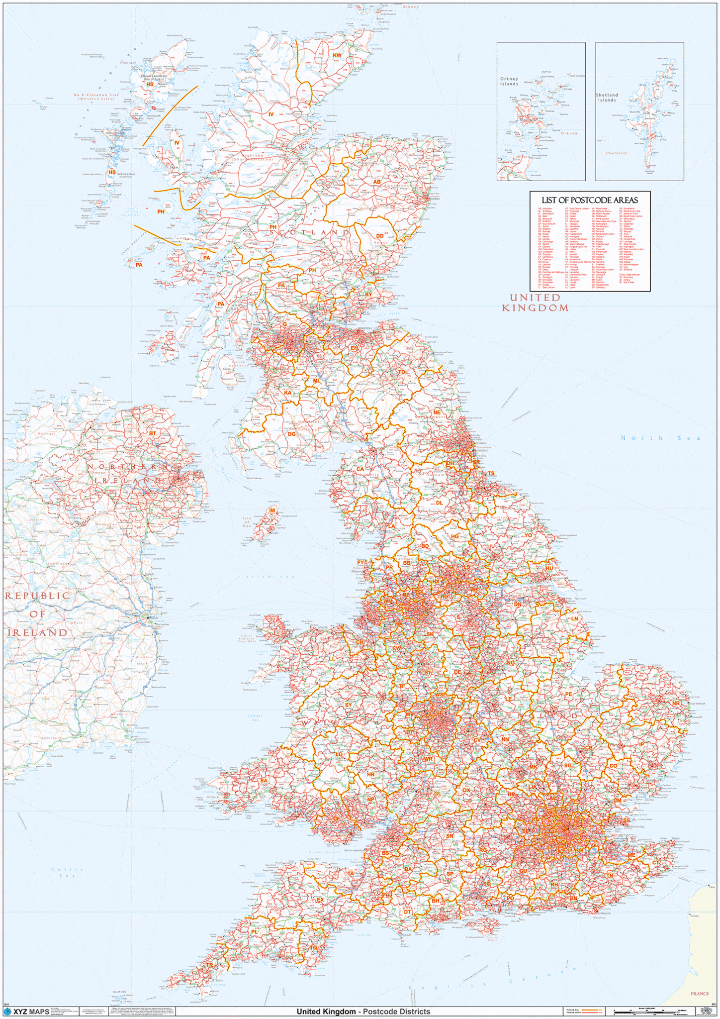
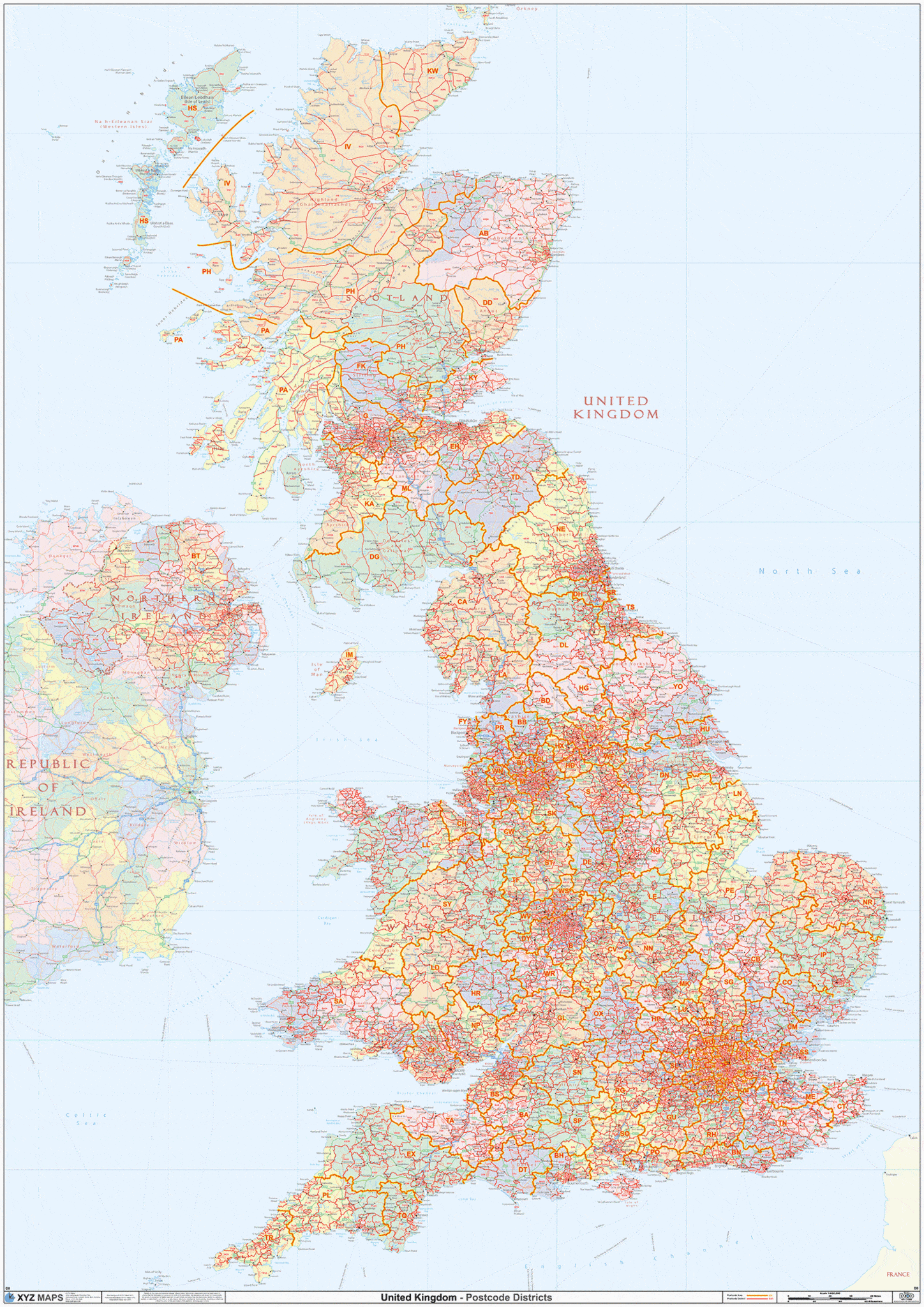
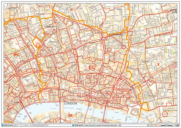
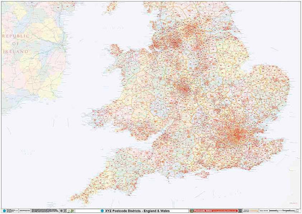
England & Wales Postcode District Map (D9)
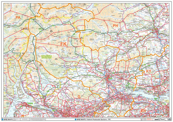
Falkirk Postcode Map (FK)
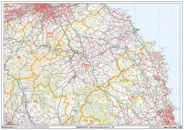
Galashiels Postcode Map (TD)
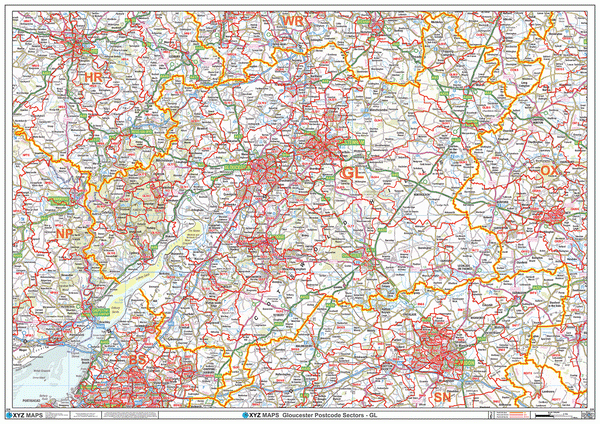
Gloucester Postcode Map (GL)
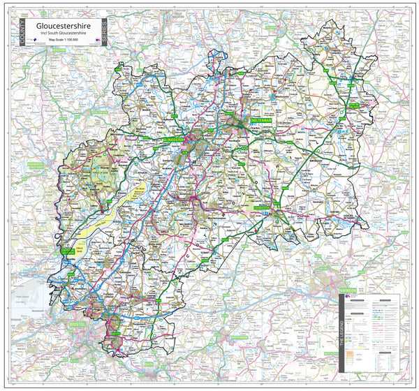
Gloucestershire County Map (2021)
Greater London Authority Borough Postcode District Map (LAD)
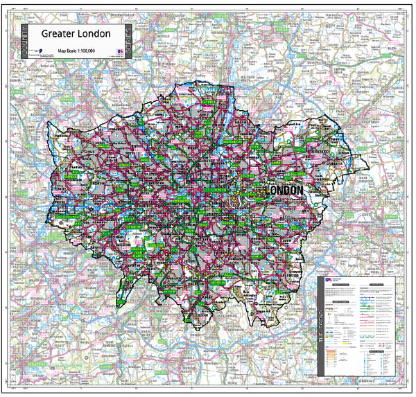
Greater London County Map (2021)
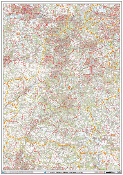
Guildford Postcode Map (GU)
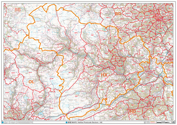
Halifax Postcode Map (HX)
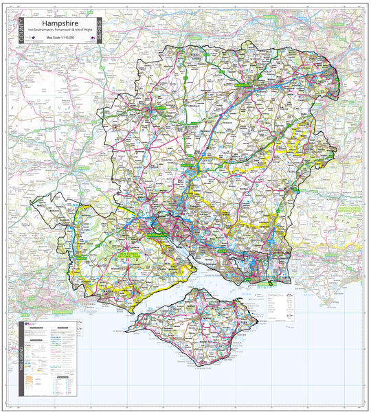
Hampshire County Map (2021)
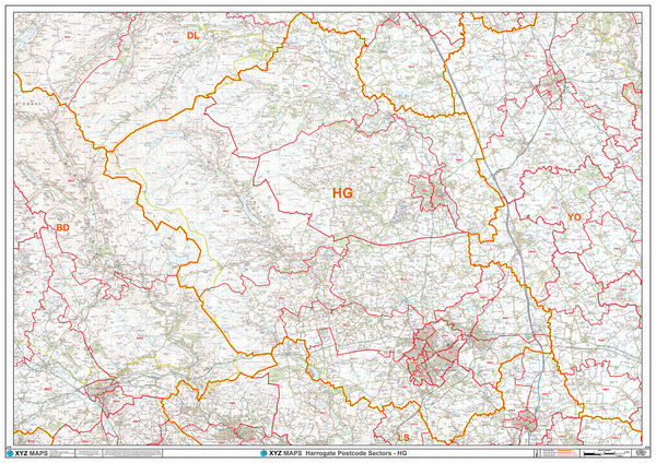
Harrogate Postcode Map (HG)
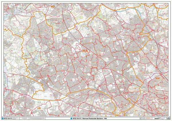
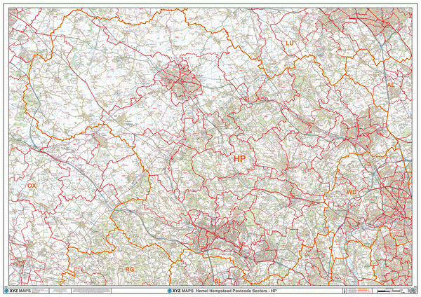
Hemel Hempstead Postcode Map (HP)
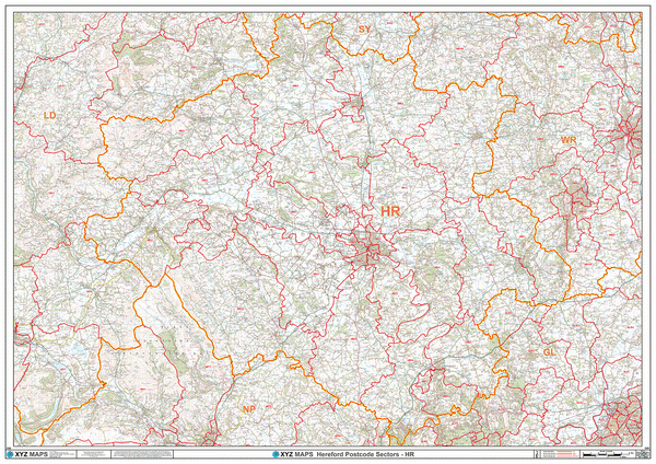
Hereford Postcode Map (HR)
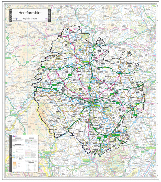
Herefordshire County Map (2021)
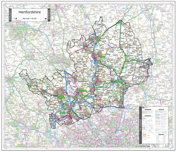
Hertfordshire County Map (2021)
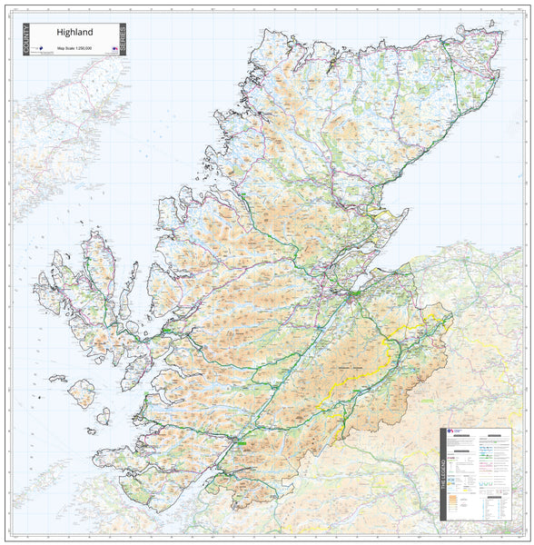
Highlands County Map (2021)