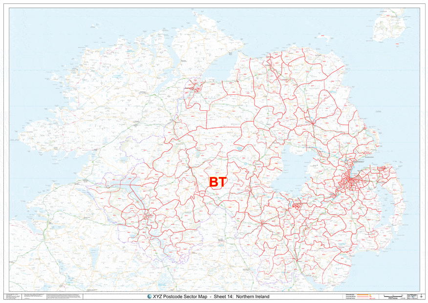
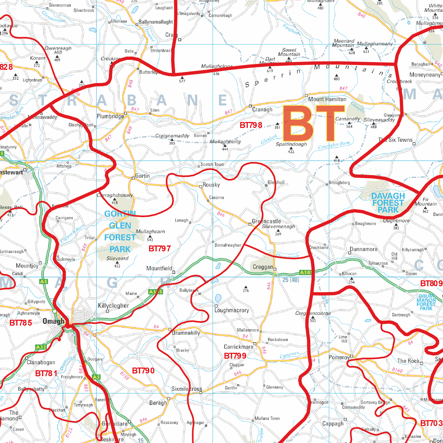
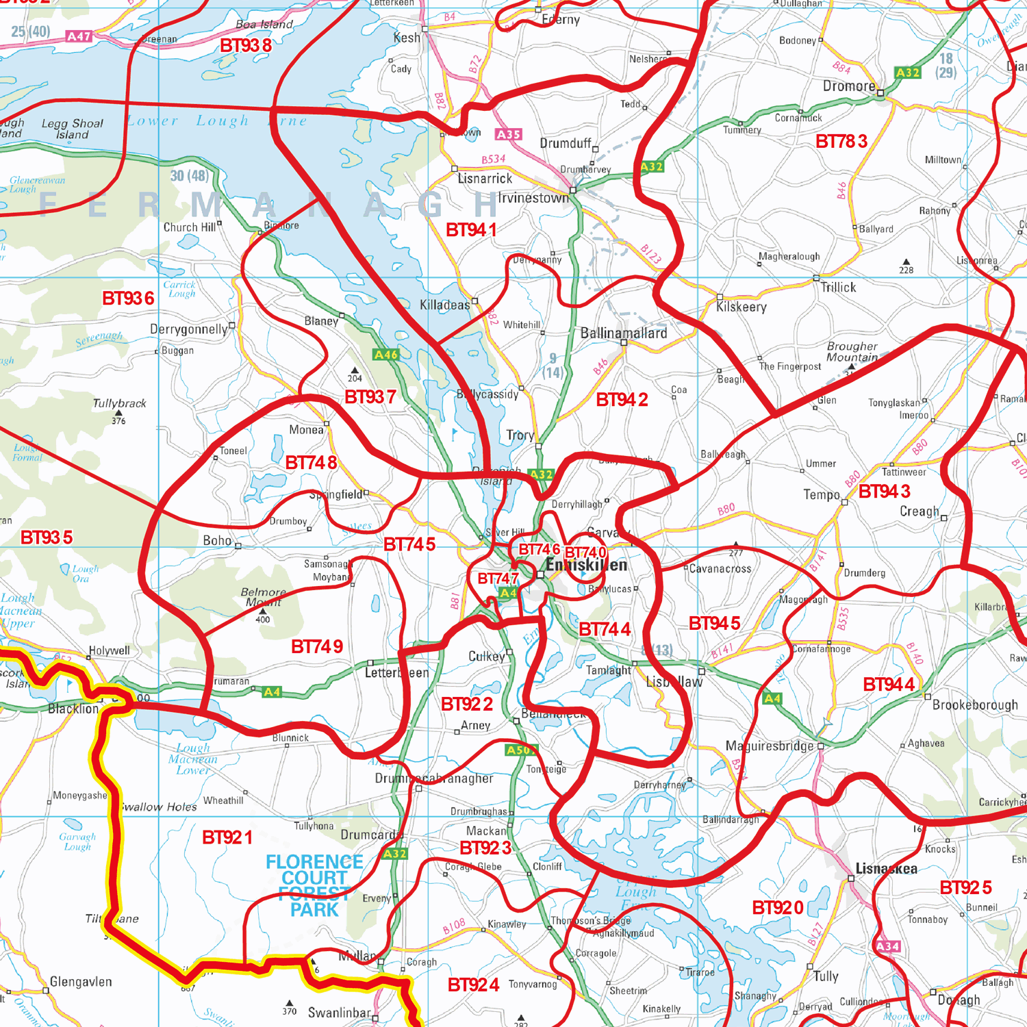
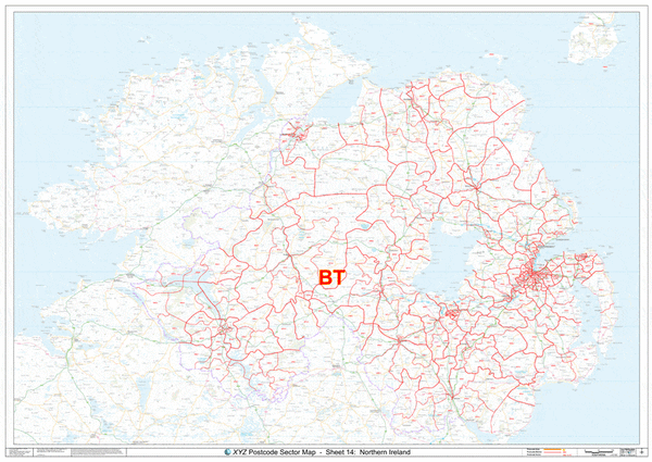
BT Postcode Map for the Northern Ireland Postcode Area GIF or PDF Download
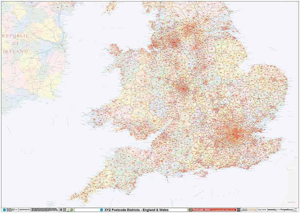
England & Wales Postcode District Map GIF or PDF Download (D9)
Aberdeen Postcode Map (AB)
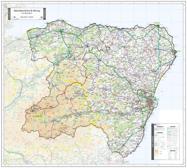
Aberdeenshire Moray, Angus and Forfar County Map (2021)
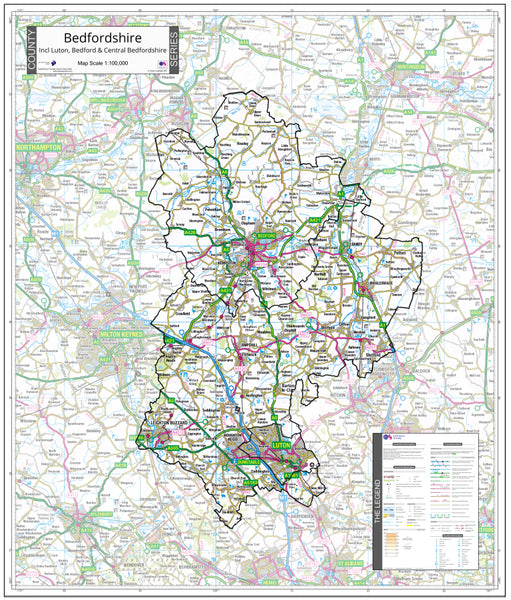
Bedfordshire County Map (2021)
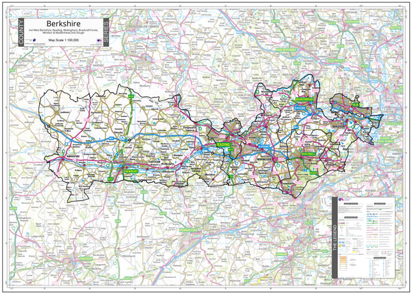
Berkshire County Map (2021)
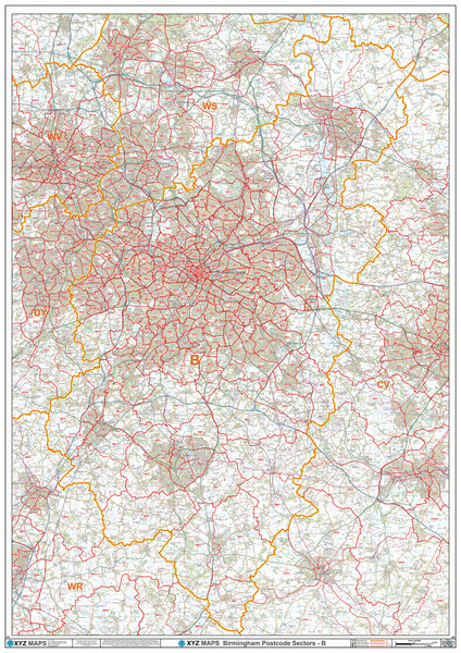
Birmingham Postcode Map (B)
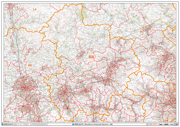
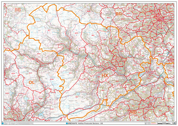
Blackburn Postcode Map (BB)
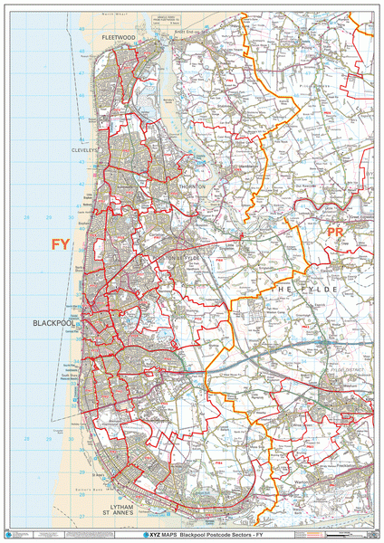
Blackpool Postcode Map (FY)
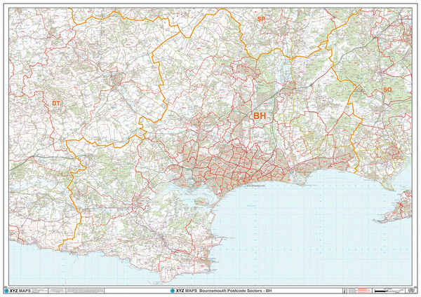
Bournemouth Postcode Map (BH)
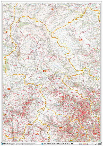
Bradford Postcode Map (BD)
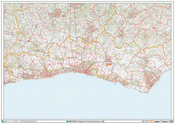
Brighton Postcode Map (BN)
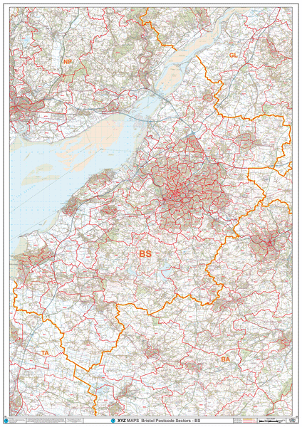
Bristol Postcode Map (BS)
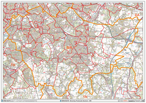
Bromley Postcode Map (BR)
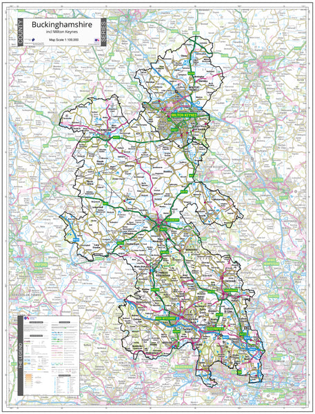
Buckinghamshire County Map (2021)
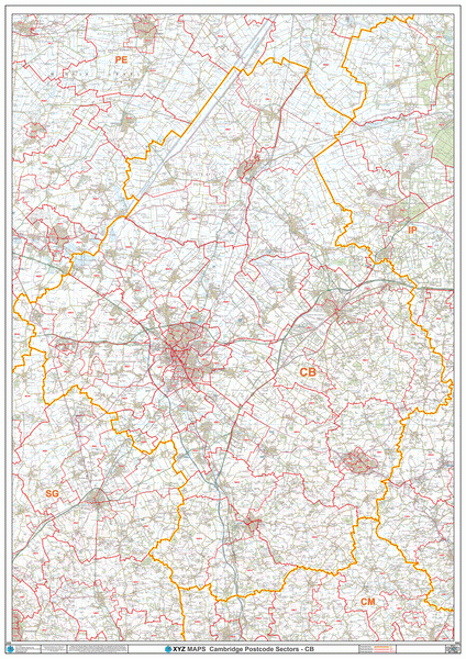
Cambridge Postcode Map (CB)
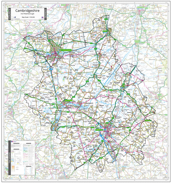
Cambridgeshire County Map (2021)
Canterbury Postcode Map (CT)
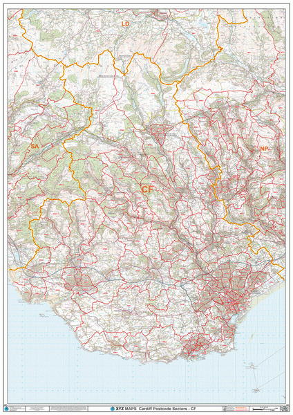
Cardiff Postcode Map (CF)
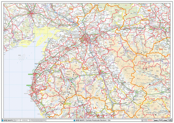
Carlisle Postcode Map (CA)
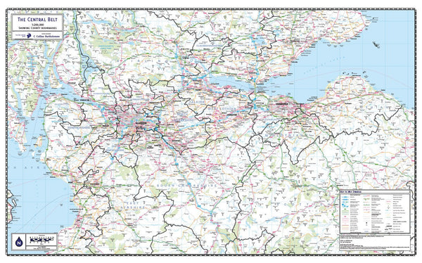
Central Belt of Scotland County Map (2021)
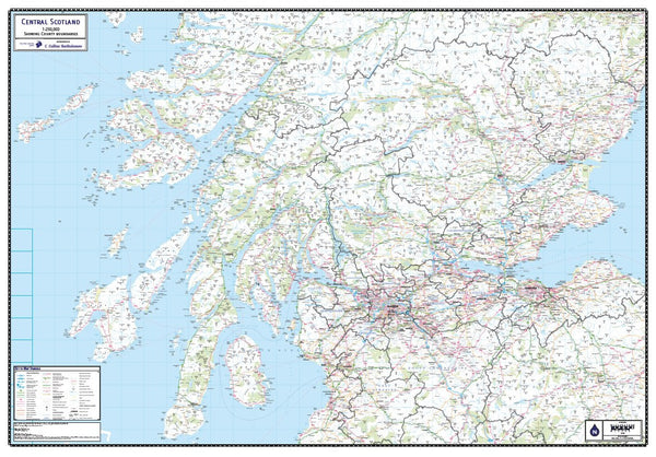
Central Scotland County Map (2021)
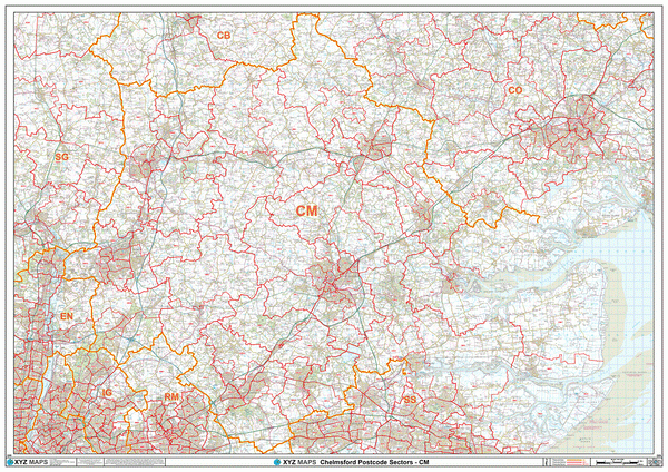
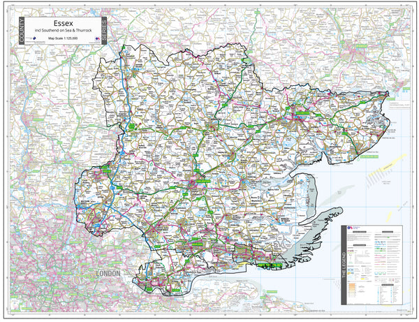
Chelmsford Postcode Map (CM)
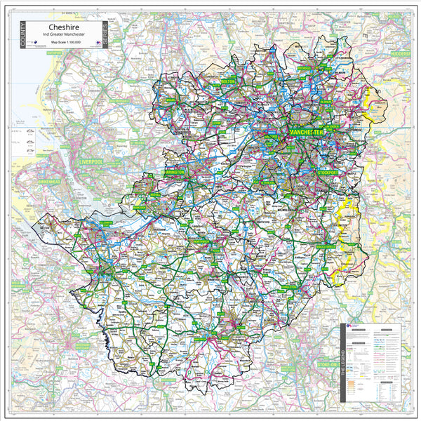
Cheshire County Map (2021)
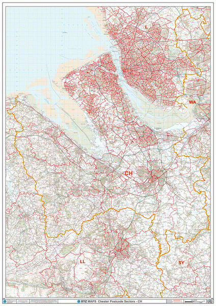
Chester Postcode Map (CH)
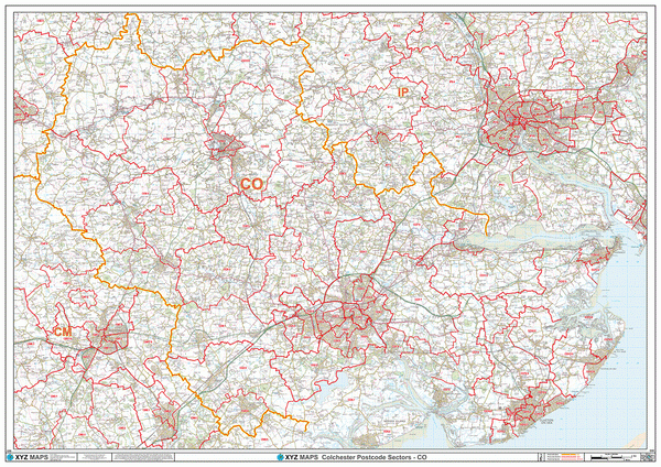
Colchester Postcode Map (CO)
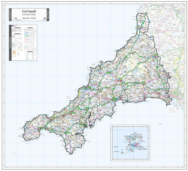
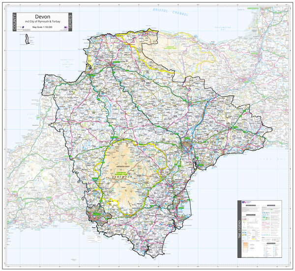
Cornwall County Map (2021)
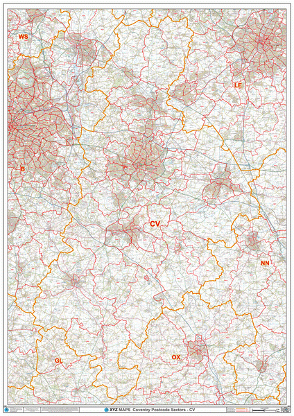
Coventry Postcode Map (CV)
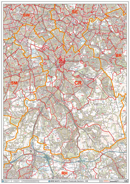
Croydon Postcode Map (CR)
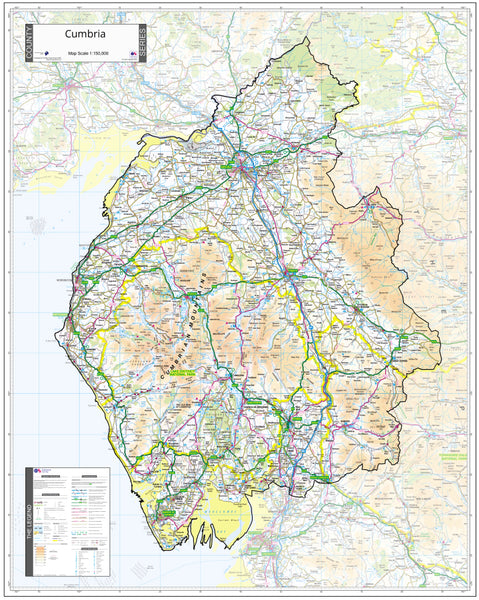
Cumbria County Map (2021)
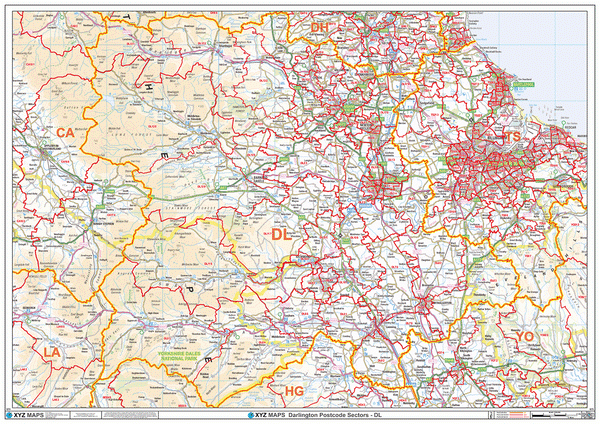
Darlington Postcode Map (DL)
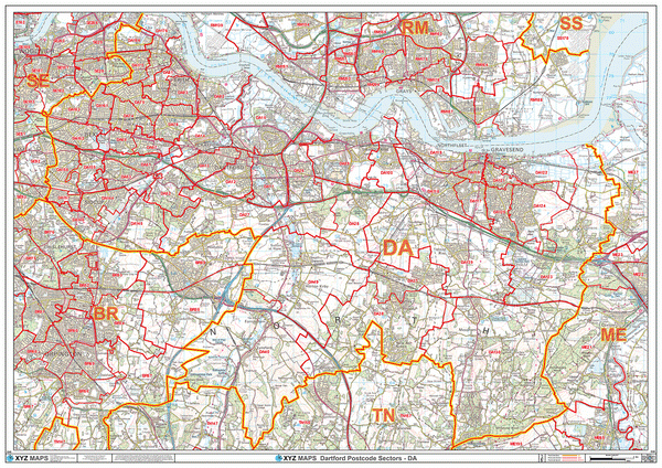
Dartford Postcode Map (DA)
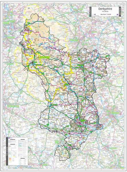
Derbyshire County Map (2021)
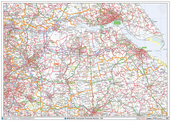
Doncaster Postcode Map (DN)
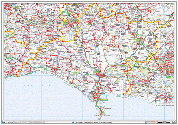
Dorchester Postcode Map (DT)
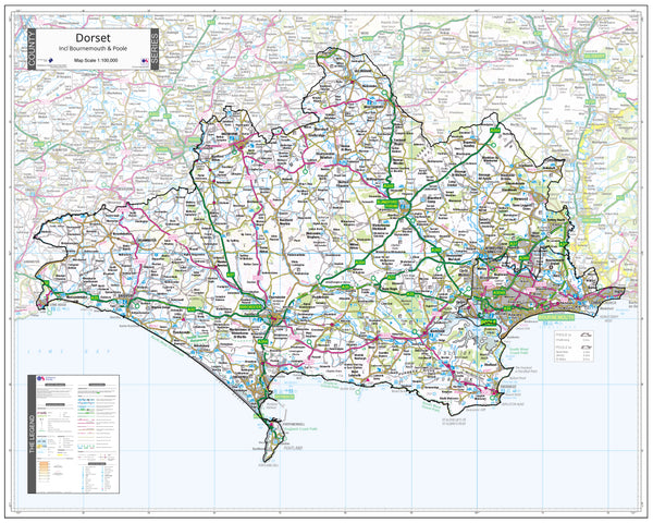
Dorset County Wall Map - Latest Ordnance Survey Boundaries (2021)
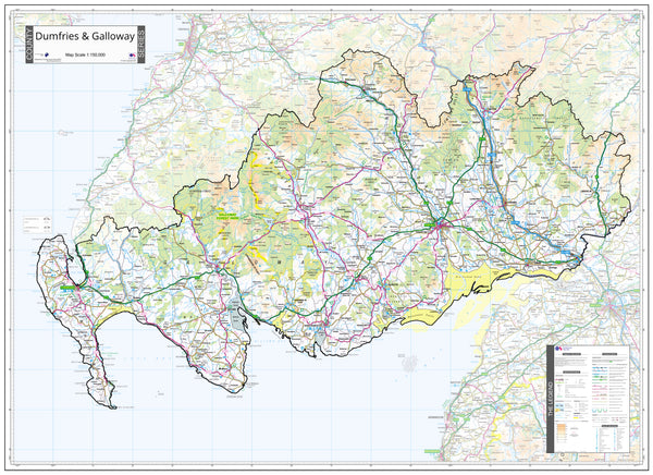
Dumfries and Galloway County Map (2021)
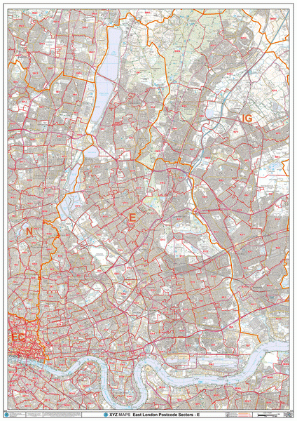
East London Postcode Map (E)
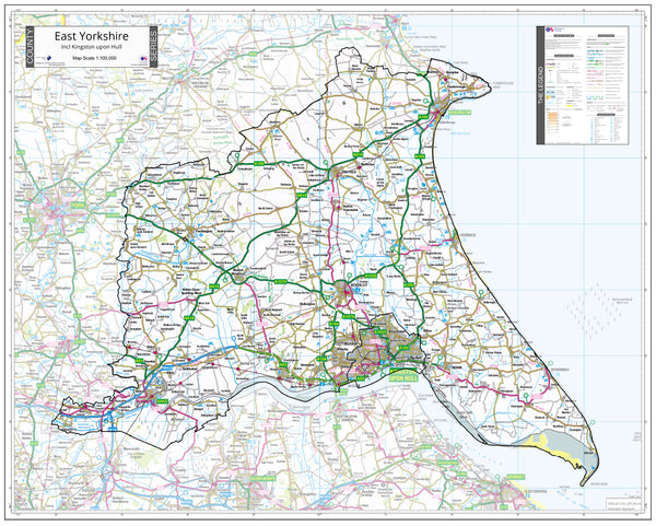
East Yorkshire County Map (2021)
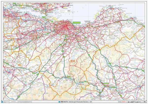
Edinburgh Postcode Map (EH)
Enfield Postcode Map (EN)
England & Wales Postcode District Map (D9)
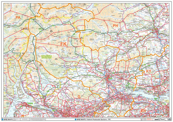
Falkirk Postcode Map (FK)
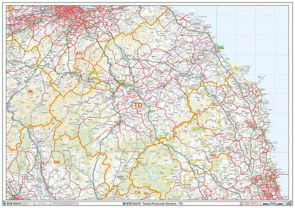
Galashiels Postcode Map (TD)
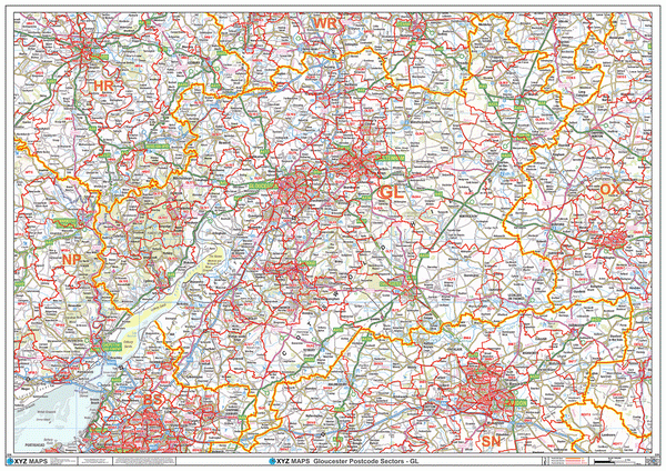
Gloucester Postcode Map (GL)
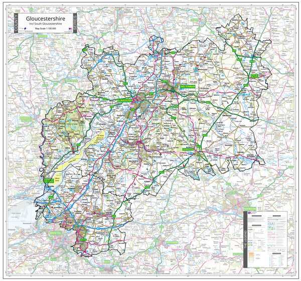
Gloucestershire County Map (2021)
Greater London Authority Borough Postcode District Map (LAD)
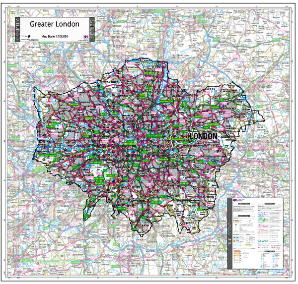
Greater London County Map (2021)
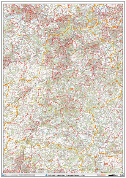
Guildford Postcode Map (GU)
Halifax Postcode Map (HX)
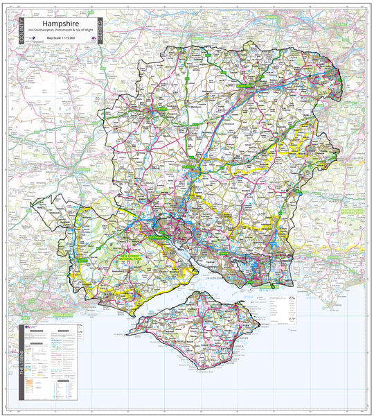
Hampshire County Map (2021)
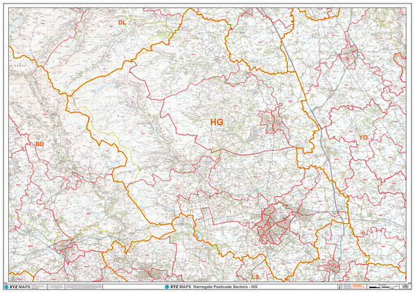
Harrogate Postcode Map (HG)
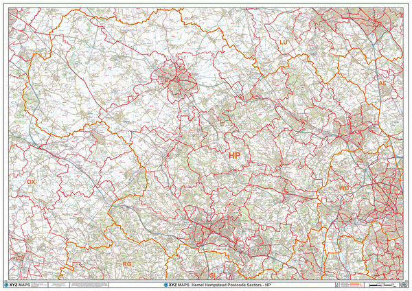
Hemel Hempstead Postcode Map (HP)
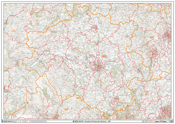
Hereford Postcode Map (HR)
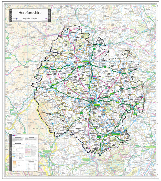
Herefordshire County Map (2021)
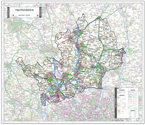
Hertfordshire County Map (2021)
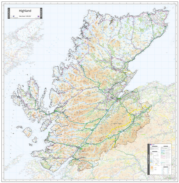
Highlands County Map (2021)
AB Postcode Map for the Aberdeen Postcode Area GIF or PDF Download
Aberdeenshire Postcode Sector Map (S20) GIF or PDF Download
AL Postcode Map for the St Albans Postcode Area GIF or PDF Download
B Postcode Map for the Birmingham Postcode Area GIF or PDF Download
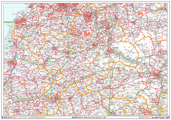
BA Postcode Map for the Bath Postcode Area GIF or PDF Download
BB Postcode Map for the Blackburn Postcode Area GIF or PDF Download
BD Postcode Map for the Bradford Postcode Area GIF or PDF Download
BH Postcode Map for the Bournemouth Postcode Area GIF or PDF Download
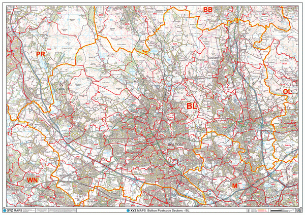
BL Postcode Map for the Bolton Postcode Area GIF or PDF Download
BN Postcode Map for the Brighton Postcode Area GIF or PDF Download
BR Postcode Map for the Bromley Postcode Area GIF or PDF Download
BS Postcode Map for the Bristol Postcode Area GIF or PDF Download
BT Postcode Map for the Northern Ireland Postcode Area GIF or PDF Download
CA Postcode Map for the Carlisle Postcode Area GIF or PDF Download
CB Postcode Map for the Cambridge Postcode Area GIF or PDF Download
Central East Scotland Postcode Sector Map (S18) GIF or PDF Download
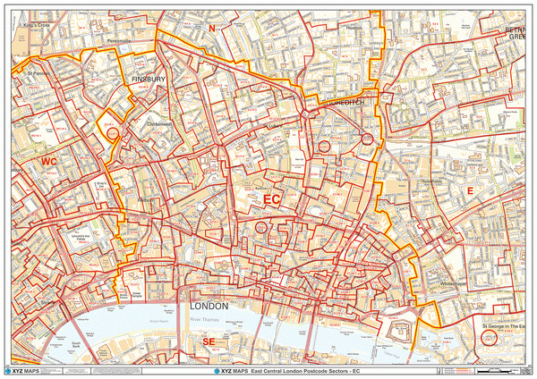
Central London Postcode Map With Streets (C1) GIF or PDF Download
Central Southern England Postcode Sector Map (S3) GIF or PDF Download
Central West Scotland Postcode Sector Map (S17) GIF or PDF Download
CF Postcode Map for the Cardiff Postcode Area GIF or PDF Download
CH Postcode Map for the Chester Postcode Area GIF or PDF Download
CM Postcode Map for the Chelmsford Postcode Area GIF or PDF Download
CO Postcode Map for the Colchester Postcode Area GIF or PDF Download
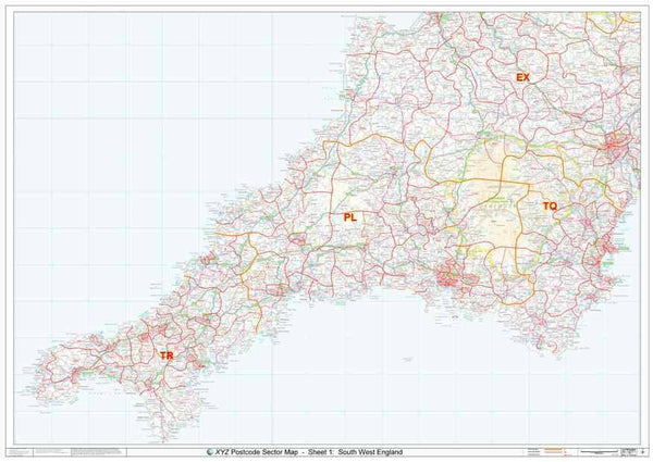
Cornwall & West Devon Postcode Sector Map (S1) GIF or PDF Download
CR Postcode Map for the Croydon Postcode Area GIF or PDF Download
CT Postcode Map for the Canterbury Postcode Area GIF or PDF Download
CV Postcode Map for the Coventry Postcode Area GIF or PDF Download
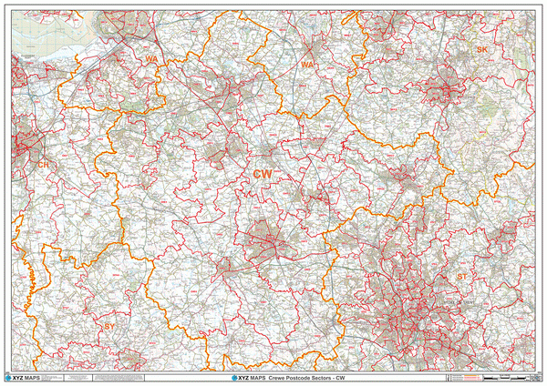
CW Postcode Map for the Crewe Postcode Area GIF or PDF Download
DA Postcode Map for the Dartford Postcode Area GIF or PDF Download
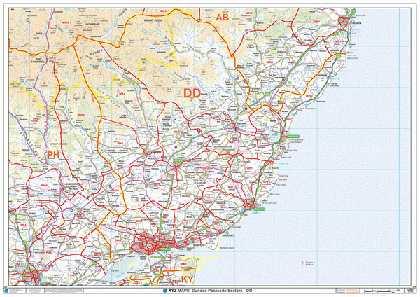
DD Postcode Map for the Dundee Postcode Area GIF or PDF Download
DG Postcode Map for the Dumfries & Galloway Postcode Area GIF or PDF Download
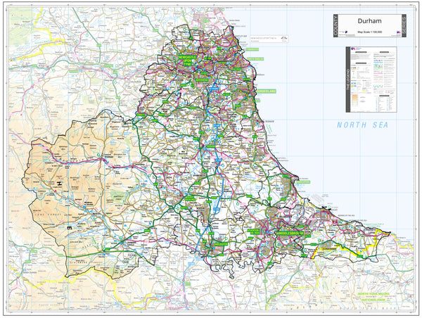
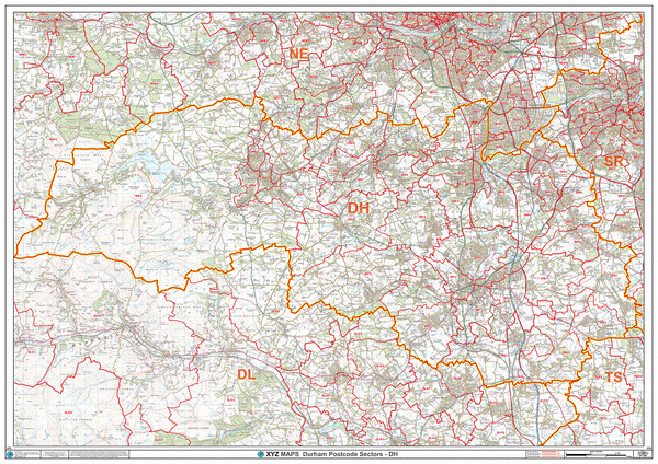
DH Postcode Map for the Durham Postcode Area GIF or PDF Download
DL Postcode Map for the Darlington Postcode Area GIF or PDF Download
DN Postcode Map for the Doncaster Postcode Area GIF or PDF Download
DT Postcode Map for the Dorchester Postcode Area GIF or PDF Download
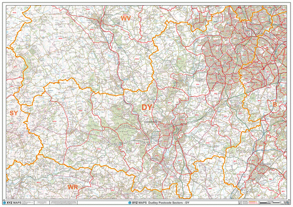
DY Postcode Map for the Dudley Postcode Area GIF or PDF Download
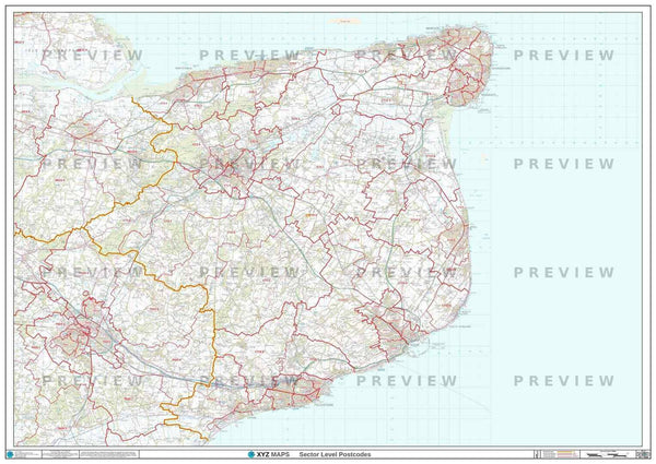
East Anglia Postcode Sector Map (S8) GIF or PDF Download
East Devon, Dorset & Somerset Postcode Sector Map (S2) GIF or PDF Download
East Midlands Postcode Sector Map (S7) GIF or PDF Download
EN Postcode Map for the Enfield Postcode Area GIF or PDF Download
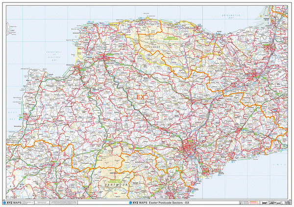
EX Postcode Map for the Exeter Postcode Area GIF or PDF Download
FK Postcode Map for the Falkirk Postcode Area GIF or PDF Download
FY Postcode Map for the Blackpool Postcode Area GIF or PDF Download
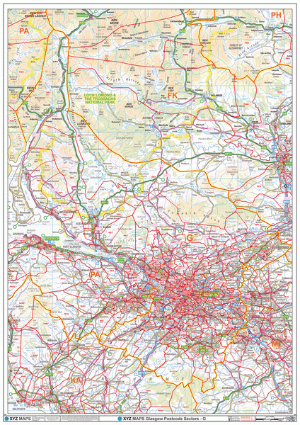
G Postcode Map for the Glasgow Postcode Area GIF or PDF Download
GL Postcode Map for the Gloucester Postcode Area GIF or PDF Download
Greater Birmingham Area Postcode Sector Map (G2) GIF or PDF Download
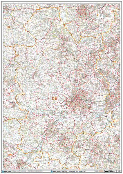
Greater Derby (DE) Area Postcode Sector Map (G9) GIF or PDF Download
Greater Edinburgh Area Postcode Sector Map (G5) GIF or PDF Download
Greater Liverpool Area Postcode Sector Map (G6) GIF or PDF Download
Greater Manchester Area Postcode Sector Map (G3) GIF or PDF Download
Greater Nottingham (NG) Area Postcode Sector Map (G11) GIF or PDF Download
Greater Oxford (OX) Area Postcode Sector Map (G18) GIF or PDF Download
Greater Peterborough (PE) Area Postcode Sector Map (G10) GIF or PDF Download
Greater Sheffield Area Postcode Sector Map (G7) GIF or PDF Download
GU Postcode Map for the Guildford Postcode Area GIF or PDF Download
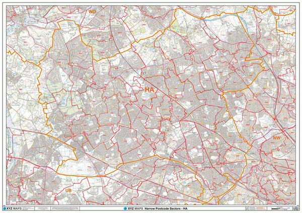
HA Postcode Map for the Harrow Postcode Area GIF or PDF Download
HD Postcode Map for the Huddersfield Postcode Area GIF or PDF Download
HG Postcode Map for the Harrogate Postcode Area GIF or PDF Download
HP Postcode Map for the Hemel Hempstead Postcode Area GIF or PDF Download