0 Cart
Added to Cart
    You have items in your cart
    You have 1 item in your cart
    Total
    Check Out Continue Shopping

    News — map

    Essential Accessories for Wall Maps

    Essential Accessories for Wall Maps

    We often get asked by customers if we sell accessories for their map such as marker pens or fixings to hang maps on their walls.

    The truth is that we don't because we can't compete with the prices of these items on Amazons so rather than sell them at inflated prices, here are our picks of Amazon's map accessories which work will with our range of maps.

    Wall Fixings

    One of the essential accessories you need for a wall map, are fixings with which to hang the map on the wall! We have tried various solutions for a laminated (not framed) map:

    • Drawing pins obviously damage the map and the wall
    • Sellotape is not reliable and tends to pull paint off the wall
    • Blu tack is a better option but again isn't that reliable.

    The best solution we have found are 3M hanging strips. These strips fix to the wall and the back of your map (or map frame) and fix your map to the wall with velcro! They are easy to use, don't damage the wall or your map and the best solution we have found.
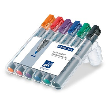
     

    Marker Pens

    The first thing to clarify with regard to marker pens is that assuming you want to be able to draw on your map and then remove the pen at some point there are two conditions.

    1. Your map must be laminated or plastic coated. If you draw on a paper map with any kind of marker pen then it will be permanent.
    2. The marker pens must be dry wipe/ water based marker pens. If you use permanent markers your annotation on the map will be just that - permanent!

    So without further ado, here are some of our recommendations for marker pens you can use with our range of plastic coated wall maps. Just remember that if you are drawing territory or franchise boundaries on your map, the thicker the pen the better!

    Erasers & Wipes

    In keeping with Murphy's Law, it is certain that as soon as you have drawn your territories, franchise areas or store locations on a map, someone will walk into the office and announce a change that immediately messes up your beautiful artwork!

    So now you have to clean your boundaries boundaries off the map and redraw them. And the question is, what is the best product to quickly and easily remove pen from the map?

    We have found that whiteboard erasers tend to smudge the pen and leave residue. So the best thing we have found are either whiteboard wet wipes or a simple whiteboard solution cleaner and a cloth.

    Again, for convenience, our top picks our shown below for reference.


    Map Stickers

    Once your Postcode map is on the wall, one of the first things you want to do is plot the locations of stores, key customers, franchisee locations or staff. 

    Common methods are map pins or magnets but these do have drawbacks. Map pins require the map to have a cork backing but still damage the map itself and puncture the protective plastic coating.

    Magnets are an option but require the map to be mounted with a magnetic or metal backing.Even then if the magnets aren't strong enough they can have a tendency to slide or fall off. So, as fans of keeping things simple, we like stickers! And the beauty of these is that they are cheap and also removable as long as they are used on a plastic coated/ encapsulated map. Here are our top picks from Amazon:


    An Antique World Map Masterpiece

    You don't have to like maps to appreciate this work of art!

    Willem Blaeu, the famous Dutch cartographer and appointed map maker for the Dutch East India Company, had two sons Johannes (Joan) and Cornelius Blaeu who continued his map making business after his death in 1638. This stunning world map was published circa 1665 although we can't determine how much of the map is Willem's or his sons work.

    The map is famous for its elaborate ornamentation, embellished with ships, sea monsters, compass roses, and ornate border panel.

    The map incorporates some of the classic early 17th Century cartographic misconceptions, including California shown as a separate island to the North American mainland, the lack of coastal detail around Alaska and NW America, a narrow strait between North and South America and so on.

    Whether you like perusing old maps or just want a wall display to finish off an office or a sitting room,  this huge map provides an historic elegance and style to any room without dominating too much.

    For more information visit our Blaeu World map product page.


    Free Postcode Maps On Google Maps

    We have been playing with google maps to provide a simple and free online Postcode map resource for quite some time.

    After some review about how to best make this work - in particular with some Google Maps limitations - we are trying out a new site which is dedicated to the provision of free online Postcode maps.


    Currently the site utilises the Google Maps search tool to allow you to search for a town, Postcode or county in the UK and display the Postcode Districts or Sectors for that area. Postcode District and Sector boundaries can be toggled on or off on the map by simple buttons in the top right of the map.

    In addition, there are menu options to view predefined Postcode maps for selected towns, Postcode Areas and Counties.

    We hope this is the first phase of an on-going Postcode mapping development and, as such, we have a competition running for visitors to give us their feedback on what they would like the site to do next. These responses will help drive the next features we will look to add to the site over the coming months either free of charge or for a small subscription fee.

    We welcome all feedback on the site so please hop over to have a look and use one of the methods on the site to let us know what you think and how you think the site could be improved.

    Thanks in advance :-)

    Read more

    London Postcode Maps


    Our new London Postcode Maps website is now online!

    As we get many enquiries for Postcode reference data, maps and books for London we thought it may be easier to dedicate a site to the subject. So the new site includes a whole range of products and materials including:

    - Postcode wall maps
    - Postcode map images
    - London Guides which include Postcode information
    - Postcode data and spread sheets
    - Postcode boundaries for London
    - A-Z maps showing Postcodes
    - And some freebies...!

    So have a look at the new site and tell us what you think - all suggestions for information or products you think would be useful aadditions to the site are warmly welcome.

    Read more