Postcode Update September 2016

The Postcode system is a continually evolving structure.
As towns are redeveloped, housing stock introduced and business centres established; Postcodes are created to accommodate new addresses or changed to keep the postal system as efficient as possible.
These changes can have significant impact on organisations who rely on Postcode related information as part of their business operations whether it is capturing correct customer addresses, planning marketing and PR campaigns or managing sales territories.
Keeping Postcode information up to date is therefore essential for many businesses which is why we source and apply the latest Postcode and Government information updates to all of our data and map products every 3 months.
For the latest September 2016 update, we wanted to quantify how many changes have occurred and also see if there are any geographical patterns in where the changes are happening.
Postcode Changes In Numbers
Following the September 2016 update, there are now 1,759,280 current Postcodes in use across the United Kingdom.
- Since the previous update in June, there have been 4,406 new Postcodes introduced to, and 3,141 Postcodes retired from, the UK Postcode system.
- The Postcode Area with the highest number of new Postcodes in the last 3 months is B (Birmingham) with 102 new Postcodes.
- The Postcode Area with the highest number of Postcodes being retired in the previous 3 months is M (Manchester) with 124 retired Postcodes.
These last two facts are not surprising given the volumes of residential and commercial properties in these two areas. In fact Birmingham has more households than any other Postcode Area in the UK including BT, which is the Postcode Area for Northern Ireland!
Postcode Changes Mapped Out
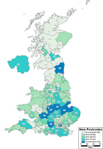
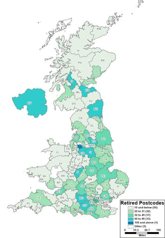
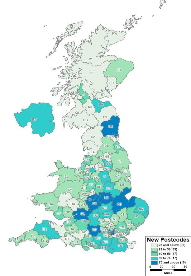
Out of curiosity, we wanted to visualize where most of the changes occurred and mapped out the number of new Postcodes and retired Postcodes by Postcode Area across the UK. This is how the changes are distributed across the UK:

Fig 1. The Volume Of New Postcodes By Postcode Area

Fig 1. The Volume Of Retired Postcodes By Postcode Area
Interestingly, there appears to be a higher volume of new Postcodes in the last 3 months in the Midlands area than the South East but a higher proportion of retired Postcodes in the North (especially Manchester).
For the next update we are also planning to look at the percentage of Postcodes created or retired in each Area.
How Does This Affect Postcode Products?
Changes to Postcodes have a direct impact on a whole range of Postcode based products which must be updated to reflect the ever-changing Postcode landscape. Here are some examples of how Postcode changes may affect you:
If you use Postcodes for Business Analysis
Look up tables which relate Postcodes to other information such as Parliamentary Constituencies, Local Authority Information, Grid References must all be updated to ensure the analysis of Postcode related records and information is accurate and up to date.
In addition to updating the Postcodes themselves, we also take the opportunity to update all the related information such as MP names, Ward names and so on to ensure these references are also current.
If you use Postcodes for Address Management
Sometimes existing Postcodes do change for households and people move in to new build homes with brand new addresses and Postcodes. Companies providing services or delivering products to these homes need to ensure their systems are up to date to capture and update these new addresses.
Our Royal Mail PAF databases are therefore all updated to reflect the latest Postcode changes and help companies keep their customer data accurate and up to date.
If you use Postcodes for mapping Sales Territories or Franchise Areas
Changes to the Postcode system can also impact the Postcode boundaries themselves which are widely used in GIS and mapping software such as MapInfo, ESRI and Intergraph products for a range of business tasks including mapping sales territories and planning franchise areas.
New Postcodes can change the Postcode structure geographically and we meticulously review these changes to ensure all our digital Postcode boundary files reflect these latest changes.
The next Postcode update is expected to take place in December 2016 but if you have any questions on the latest Postcode changes and how they may affect you please contact us.

