Mapping Our Top 10 Scariest Places In London
We love maps. We love Halloween. And we love London.
So what better way to get into the spirit of Halloween this year than by mapping our top 10 spookiest places in London. Those of a nervous disposition can look away now...
And in no particular order:
#1 The Ten Bells
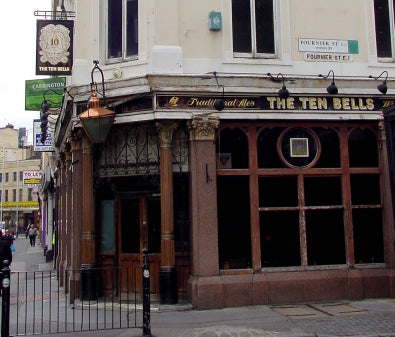
Image source: Wikimedia Commons
In the late 1990's live in staff whose bedrooms were on the upper floors of the Pub, were complaining of alarming encounters with the ghost of an old man dressed in Victorian clothing. Staff reported that they would often be awoken in the early hours of the morning, to find the phantom form of the old man lying beside them on the bed! As soon as they would cry out in shock the ghostly figure would vanish. Staff with no previous knowledge of his ghost would often report seeing him, and their descriptions would always be the same.
A tenant who lived on the premises in 2001 would often hear phantom footsteps followed by the faint sound of laughter outside his door, when he was the only person on the premises. When going down the stairs to the bar he would often be pushed hard on the back by invisible hands, several times this resulted in him ending up in a heap at the bottom of the stairs.
A psychic was brought to the pub to see what she could pick up at the premises. Upon reaching the top floor, she paused outside one of the rooms and refused to go any further. She said that she could sense that something terrible had happened in the room and was almost certain that it involved the brutal death of a baby in the 19th century.
Lindsay Siviter, a leading researcher and expert on the Jack the Ripper Crimes, was being shown around the pub a few years later and had been allowed access to the roof space. She noticed some material embedded in the floor behind the water tank and pulling at it found it was a sack tied at the top. Opening it she found it contained a moldy set of Victorian baby clothes that appeared to have been slashed with a knife. Intriguingly the tank was directly over the room that the psychic had refused to enter.
Source: ghost-story.co.uk
#2 Greenwich Foot Tunnel
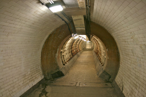
Image Source: Wikimedia Commons
Those visiting the tunnel from Cutty Sark Gardens experience echoes and an unsettling time as they walk the 370 metres of tunnel. Although they are no resident ghosts, many visitors say they feel a strong presence and the feeling of being followed until reaching the other side.
Source: wegoplaces
#3 Bleeding Heart Yard
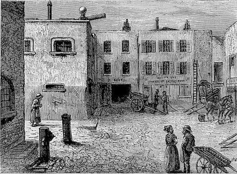
Image Source: Wikipedia
This small square of Bleeding Heart Yard in Farringdon has a horrific history. Legend has it that on January 27 1626 the mutilated body of society beauty Lady Elizabeth Hatton was found in the cobbled courtyard. She had been murdered “torn limb for limb, but her heart still pumping blood.”
Source: Timeout
#4 City of London Cemetery & Crematorium
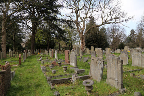
Image Source: Wikimedia Commons
Since the mid 1970's locals have complainted about a brilliant orange light emanating from one of the tombstones in the western section of the City of London Cemetery in Wanstead. Despite repeated attempts, investigators have been unable to find any light source outside the graveyard that could account for the phenomenon.
Source: TimeOut
#5 The Flask
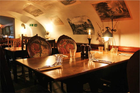
Image Source: The Flask
Every good historic pub should have a haunting or two, and The Flask is no exception. You might run into the ghost of a Spanish barmaid who hanged herself in the pub's cellar (now a seating area), over an unrequited love for the publican. Look out also for a chap in Cavalier uniform occasionally seen crossing the room in the main bar and vanishing into a pillar. And while he doesn't haunt the pub (as far as we know) Dick Turpin is reputed to have spent some time in the wine store while on the run from the authorities.
On to slightly more grisly territory, and the pub's Committee Room was allegedly the scene of one of the first-ever autopsies, secretly performed during the days of graverobbing with a fresh body from Highgate Cemetery.
Source: The Flask
#6 The Spaniards
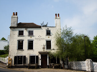
Image Source: The Spaniards Inn
The building was transformed into an inn by Francesco and Juan Porero who fought a duel over a woman. As a result, Juan was killed and buried in the garden. His ghost is said to haunt the inn.
There are also reports of a ghostly man figure often seen outside the road of the inn and thought to be Dick Turpin. There is also a lady in white often seen in the pub garden, who is thought to be one of Turpin’s victims. Many pub goers have also reported a strange hand clutching to their clothes from an invisible source.
Source: wegoplaces
#7 The Old Queens Head
Image Source: The Old Queens Head
The Old Queen’s Head is said to be haunted by a woman and a young girl. The girl has apparently been heard running in the pub when t was supposed to be empty and the pubs website says she has been running ahead of people up the stairs. There are also reports of hearing her crying and the slamming of doors. Some sources cite that the woman and young girl are dressed in Tudor clothing and that it is more likely to happen on the first Sunday of the month.
The paranormal investigator and author Jack Hallam interviewed a former landlord of The Old Queen’s Head named Arthur Potter, (an account of this appeared in the Haunted Pub Guide by Guy Lyon Playfair) ‘His wife and daughter were already getting used to hearing the patter of footsteps, like those of a small child, usually late in the afternoon. They thought it must be a little girl, since the ‘swish and rustle’ of a long dress could also be heard. Early one morning Potter found the staircase light switch out of order and had to grope his way down in the dark. On the way he suddenly felt ‘this body, this thing’ coming up against him. He pushed whatever it was aside and tore down the rest of the stairs to the nearest light-switch. Not surprisingly, he was unable to give a very clear description of ‘this thing’
Source: Mysterious Britain
#8 Bethnal Green Tube Station
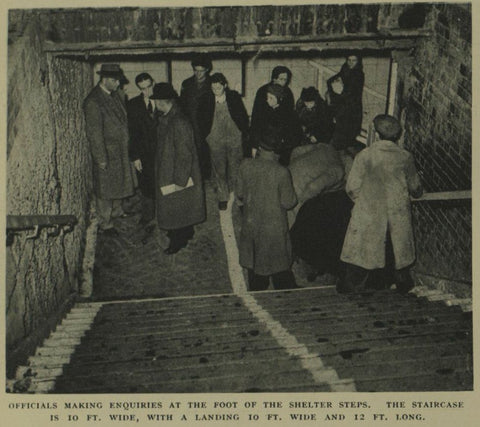
Image Source: The Haunted Palace
During World War II, Bethnal Green Tube station was one of the stations used for shelter when air raids were being carried out. On the evening of March 3rd 1943 an explosion was heard and rockets were sent into the nightcausing mass panic. In the rush to get to the shelter, 173 people were killed and most of them died of asphyxiation. There were 27 men, 84 women, and 62 children that died that night.
The tragedy left its permanent mark on the station. A very famous story is of one man who was working in the station and was getting ready to call it a night. The last train had departed and all the staff had gone home, apart from him. He secured the station, turned off the lights and went back to his office to finish off some paperwork.
He had not been back in the office very long before he started hearing children sobbing. At first he shrugged it off and carried on working, but the crying grew louder and louder. After that he heard female voices and screams, as well as noises which he could not identify. He described the sound as similar to people who are panicking. The sounds lasted for 10-15 minutes and he was so frightened that he ran out of the office and rushed to the top of the booking hallway to get away from it.
The same sounds have been heard by staff at night on many occasions.
Source: Haunted Rooms
#9 Theatre Royal, Drury Lane
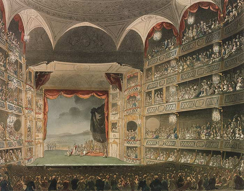
Image Source: Wikipedia
The ghost is often referred to as the Man in Grey and is generally seen in the auditorium during daylight hours. Apart from having a sword he is described as wearing a cloak, powered wig and a tricorn hat. See the figure is considered to be a lucky omen for actors about to perform as it is meant to ensure great success.
The Man in Grey tends to be linked to a skeleton that was found by workmen doing renovations. Sources differ as too when these took place, covering a time period from the1970's to the mid 1800's. The skeleton was wearing the remains of a riding coat and in his chest was a knife. It is believed that this person was killed in the 1700's.
The ghost of the comedian Dan Leno (George Wild Galvin 1860-1904) was seen by Stanley Lupino (1893-1942). He was in his dressing room after being on stage and heard some curtains being drawn back. When he looked in the mirror he saw his own face and that of Dan Leno. Stanley and a caretaker were the only people in the theatre at that time and the dressing room had been a favorite of Mr Leno. Dan Leno is buried in Lambeth cemetery.
Source: Mysterious Britain
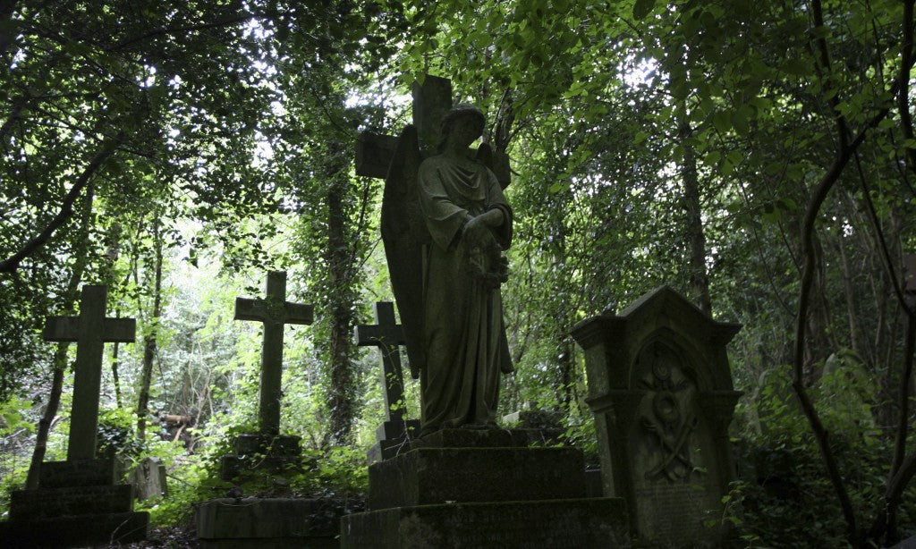
#10 Highgate Cemetery
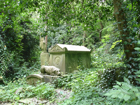
Image Source: Wikipedia
Besides having such famous people buried there as Karl Marx, Douglas Adams, and the parents of Charles Dickens, Highgate Cemetery has long been known for its ghosts, sinister activities, and other strangeness, including:
- The Highgate Vampire, who is not really a vampire in the classic sense, but a phantom that is described as a 7-foot-tall, dark male figure with piercing, hypnotic eyes and wearing a long black coat and high top hat; he seems to vanish into thin air. There have been several dozen sightings and encounters since the late 1960s.
- A man whose car broke down near the cemetery came face to face with a ghoul with glowimg red eyes that peered at him through the graveyard's iron gates.
- The ghost of an insane old woman has been seen racing among the gravestones, her gray hair flowing behind her as she searches for her children, whom she allegedly murdered.
- A dark shrouded figure has been see standing stock still and staring into space. When it is approached, it vanishes then reappears a short distance away, still staring into the void.
- A businessman was terrified by a phantom that jumped over the fence and landed right in front of him. He described it as having pointed ears, glowing eyes, and large nose. This might have been the infamous Spring-Heeled Jack.
- The floating ghost of a nun has been seen passing over the graves.
Source: Paranormal About.com
If you have been to any of these places, or want to add your own, just leave a message below. In the meantime, enjoy Halloween and stay safe!